Hundreds of Vessels Experience Positioning Errors After Israel-Iran Clash
Suspected Signal Jamming Incident at Key International Oil Transit Point
Experts Warn: "Navigation Dependent on GPS Increases Risks"
The Financial Times (FT) reported on June 17 (local time) that, following Israel's airstrike on Iran last week, there has been widespread observation of hundreds of vessels near the Strait of Hormuz displaying abnormal positioning information. These anomalies include ships heading toward land, moving in circles, or overlapping routes.
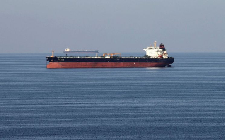
According to the FT, on the night of June 15, the Liberia-flagged oil tanker Front Eagle was sailing near the Strait of Hormuz when its satellite-based GPS repeatedly transmitted abnormal navigation signals, with its position suddenly shifting by dozens of miles at a time. Early the next morning, the vessel collided with another tanker, resulting in a fire. Although the cause of the incident has not yet been clearly identified, experts cited by the FT pointed out that such abnormal navigation tracks are clear signs of GPS jamming. GPS jamming is an increasingly common tactic in modern warfare and can significantly increase the risk of maritime accidents.
The Joint Maritime Information Center (JMIC), a multinational organization responsible for maritime safety in the Middle East, warned that "severe signal jamming appears to have originated from Iran's Bandar Abbas port," and advised vessels to use radar and visual navigation in parallel. The United Kingdom Maritime Trade Operations (UKMTO) also reported receiving numerous reports of navigation signal interference in the Gulf region.
Energy analysts are concerned that the armed conflict between Israel and Iran threatens the safety of vessels passing through the strait, potentially having a negative impact on international oil prices and supply chains. The Strait of Hormuz is a strategic chokepoint through which about one-third of the world's seaborne crude oil passes.
Frontline, the operator of the Front Eagle, denied any external interference immediately after the incident, stating that "the collision was a navigational accident unrelated to regional conflict." However, experts are focusing on the possibility that GPS jamming may have contributed to the collision. At the time of the accident, the Front Eagle changed course at the last moment and collided with another oil tanker named Adalynn.
Sal Mercogliano, a maritime historian at Campbell University, warned that "if GPS or the Automatic Identification System (AIS) is disrupted, the vessel's automatic navigation could be affected."
Todd Humphreys, a GPS expert at the University of Texas, also pointed out that "in narrow straits like Hormuz, even small GPS errors can cause vessels to stray onto dangerous paths."
Experts report that GPS jamming and spoofing (signal manipulation) are frequently used in areas such as Ukraine, the Baltic Sea, Israel, and the India-Pakistan border. While it is difficult to trace those responsible for the interference, the FT analyzed that, in this case, it is highly likely that Iran's intent was to block drone and missile reconnaissance of its own facilities.
Thomas Withington of the Royal United Services Institute (RUSI) warned that "the jamming signals are so powerful that they affect not only ships and aircraft but even mobile phones," adding that "such actions are extremely irresponsible in a navigation environment that relies on Global Navigation Satellite Systems (GNSS) and can lead to accidents."
© The Asia Business Daily(www.asiae.co.kr). All rights reserved.
![Clutching a Stolen Dior Bag, Saying "I Hate Being Poor but Real"... The Grotesque Con of a "Human Knockoff" [Slate]](https://cwcontent.asiae.co.kr/asiaresize/183/2026021902243444107_1771435474.jpg)


