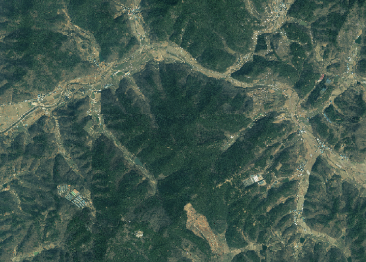
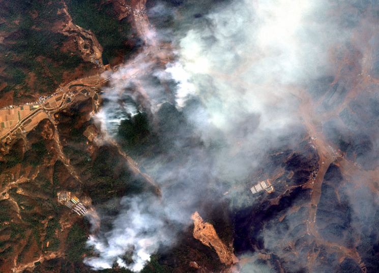
The National Geographic Information Institute of the Ministry of Land, Infrastructure and Transport announced on the 15th that it is providing emergency spatial information using national land satellite imagery to assist in the restoration of areas damaged by the large-scale wildfire that occurred last month.
This information consists of high-resolution images analyzed from satellite imagery and aerial photographs. Since 2020, related data has been provided to central government ministries and local governments during various disaster situations. The national land satellite imagery is the highest resolution imagery in Korea, allowing for the assessment of disaster-affected areas that are difficult to access. It helps scientifically analyze the damage status and efficiently support restoration work.
The Geographic Information Institute provided disaster spatial information along with images captured by the national land satellite, overseas satellite images, aerial photographs, and digital topographic maps. Previously, it supported images taken by the national land satellite for the Republic of Korea’s overseas emergency relief team dispatched for the 2023 T?rkiye earthquake relief. As a member of the International Charter for Space and Major Disasters, it recently assisted by capturing images of the earthquake-affected areas in Myanmar.
To facilitate easy use by each person in charge, related manuals and casebooks have been created and uploaded on the websites of the National Geographic Information Institute and the National Land Satellite Center. Jo Woo-seok, Director of the National Geographic Information Institute, stated, "We will further strengthen the provision of national land satellite imagery to support the restoration of damaged areas quickly and accurately."
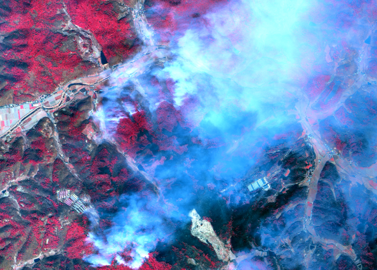 CIR image during a wildfire. The band composite image (NIR/R/G) from the Land Satellite clearly shows the wildfire damage area. The damaged area is shown in dark colors, while healthy vegetation is represented in red. Provided by the Ministry of Land, Infrastructure and Transport.
© The Asia Business Daily(www.asiae.co.kr). All rights reserved.
![Clutching a Stolen Dior Bag, Saying "I Hate Being Poor but Real"... The Grotesque Con of a "Human Knockoff" [Slate]](https://cwcontent.asiae.co.kr/asiaresize/183/2026021902243444107_1771435474.jpg)


