Government to Disclose Ground Subsidence Accident History
Limits in Linking with Underground Data Held by Local Governments
Delays Expected in Reflecting Local Government Management Plans
There are ongoing concerns that the government’s ground subsidence risk information, set to be released from next month, will be incomplete. The worry is that its usefulness will be limited because it will not include underground information investigated by local governments such as the Seoul Metropolitan Government. The government plans to encourage cooperation by disclosing the restoration rates of underground voids by each local government.
According to the maintenance industry on the 29th, the government is currently preparing to release an 'integrated underground space map' that links information held by local governments, such as ground subsidence accident histories, the status of cavity occurrences, and excavation work.
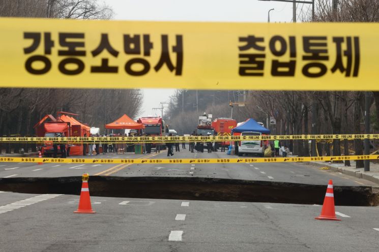 The large sinkhole that recently occurred on the road near Daemyeong Elementary School in Gangdong District. Photo by Yonhap News
Previously, on the 27th, the Ministry of Land, Infrastructure and Transport announced a 'strengthened safety management plan' focused on large-scale excavation sites to prevent ground subsidence accidents. The core of the plan is that the government will proactively conduct on-site investigations and disclose related information. This includes ground-penetrating radar (GPR) survey sections and results, cavity discoveries, and restoration status.
However, there is a high possibility that the integrated map the government intends to disclose will omit a significant amount of underground information held by local governments. Currently, the government does not have the authority to utilize underground information managed by local governments.
For example, in the case of the Seoul Metropolitan Government, the information in its self-produced 'ground subsidence safety map' has little relevance to ground subsidence risk, and the city refuses to disclose it for the security of buried facilities such as telecommunications and gas lines. This map was created by the Seoul Metropolitan Government in August last year, immediately after the sinkhole incident in Yeonhui-dong, Seodaemun-gu. It is known to classify the entire city into five risk levels and designate areas where underground construction is underway as 'risk zones' based on the level of risk.
It is expected to take considerable time to link this with the 'underground space management innovation plan' proposed as an alternative by the Seoul Metropolitan Government. Efforts to strengthen safety reviews of underground excavation works and to secure budgets for on-site measurement and risk detection are only just beginning. The 'ground subsidence monitoring network,' which was announced to expand the survey coverage to 60% by increasing the number of GPR vehicles and to detect up to 20 meters underground, is still in the process of discussing installation locations.
In response, the government plans to disclose the restoration rate of underground voids by each local government. The government believes that if information such as low restoration rates is made public in real time, local governments will feel pressured to provide additional information. In addition, there are ongoing discussions to evaluate and score the restoration rates of underground cavities by each local government, in cooperation with the Ministry of the Interior and Safety, as a way to increase the overall restoration rate.
As a result, public anxiety is increasing. After the large sinkhole incident in Myeongil-dong, reports of suspected ground subsidence have surged to more than twice the usual level. According to the Seoul Metropolitan Government and others, from March 25, the day after the Myeongil-dong incident, to April 22, there were 1,450 reports related to sinkholes, potholes, and ground subsidence over about one month. This means that an average of 50 suspected cases were reported each day.
© The Asia Business Daily(www.asiae.co.kr). All rights reserved.
![Clutching a Stolen Dior Bag, Saying "I Hate Being Poor but Real"... The Grotesque Con of a "Human Knockoff" [Slate]](https://cwcontent.asiae.co.kr/asiaresize/183/2026021902243444107_1771435474.jpg)


