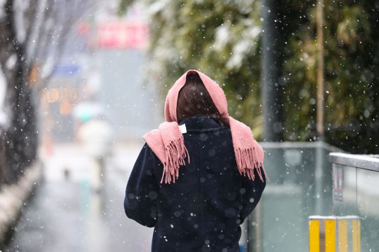
Snowfall Will Be Limited to 1?5 cm, but Black Ice Is a Concern
Strong Winds Expected in Jeju from Saturday Morning... Possible Flight Disruptions
Weekend temperatures will be 2 to 5 degrees higher than the average, so there will be no cold weather. However, rain and snow are expected mainly in the southern regions.
On Saturday, the first day of February, the morning low temperatures are expected to range from -7°C to 6°C, and the daytime highs will be between 5°C and 9°C. The expected low and high temperatures for major cities are Seoul -1°C and 8°C, Incheon -2°C and 5°C, Daejeon 1°C and 8°C, Gwangju and Daegu 3°C and 7°C, Ulsan 4°C and 7°C, and Busan 6°C and 9°C.
On Sunday, February 2, morning lows will range from -6°C to 5°C, and daytime highs will be between 5°C and 13°C. The mild weather will end on February 3, the solar term Ipchun (立春), after which severe cold will continue. The reason for the higher weekend temperatures is the southwesterly winds blowing from a low-pressure system passing over the southern sea near Jeju. However, due to the low pressure and warm, moist southwesterly winds, rain and snow will occur.
Initially, on the 31st, rain or snow will fall in the metropolitan area, inland and mountainous areas of Gangwon, Chungcheong, Honam, western inland Gyeongbuk, northeastern inland and mountainous areas of Gyeongbuk, western Gyeongnam, and Jeju. Precipitation will stop in the metropolitan area excluding southern Gyeonggi and northern inland Gangwon by evening. However, precipitation will continue until early dawn on February 1 in southern Gyeonggi and southern inland Gangwon, until afternoon in Chungcheong, and until evening in Honam.
On February 1, rain or snow will also fall in Yeongnam and Jeju. The rain and snow in Yeongnam and Jeju are expected to continue until early dawn on the 2nd. Expected snowfall by region is 1 to 5 cm in southern Gyeonggi, southern inland and mountainous Gangwon, central and northern Chungbuk, eastern Jeonbuk, northern inland and northeastern mountainous Gyeongbuk, western inland Gyeongnam, and mountainous Jeju, with about 1 cm in other areas.
During this precipitation event, caution should be taken more against black ice than snowfall damage. Although temperatures are generally high, mornings will drop below freezing, making it easy for black ice to form on roads. Especially on the early morning of February 1, freezing rain that freezes immediately upon contact with the ground is expected. When black ice on roads is a concern, driving should be avoided as much as possible, and if driving is unavoidable, reduce speed and maintain sufficient distance between vehicles.
Strong winds with gusts exceeding 70 km/h (90 km/h in mountainous areas) are expected in Jeju starting from the morning of February 1 as the low-pressure system passes nearby. A strong wind advisory will be issued, and flight operations may be disrupted, so related information should be checked in advance.
Starting from the morning of February 1, strong winds of 30 to 60 km/h and waves of 1.5 to 4.0 meters will begin in the southern offshore areas of the West Sea, southwestern offshore areas of the South Sea, Jeju waters, and outer eastern offshore areas of the South Sea. In the afternoon and night of the same day, strong winds and high waves will continue in the inner eastern offshore areas of the South Sea and southern offshore areas of the East Sea, and by early dawn on February 2, in the northern offshore areas of the East Sea.
Swells will continue to flow into the east coast until February 2, causing waves to crash over breakwaters and coastal roads. Especially until the 1st, the lunar gravitational force will be strong, causing sea levels to be higher than usual, so it is advised to avoid coastal areas to prevent accidents.
© The Asia Business Daily(www.asiae.co.kr). All rights reserved.
![Clutching a Stolen Dior Bag, Saying "I Hate Being Poor but Real"... The Grotesque Con of a "Human Knockoff" [Slate]](https://cwcontent.asiae.co.kr/asiaresize/183/2026021902243444107_1771435474.jpg)


