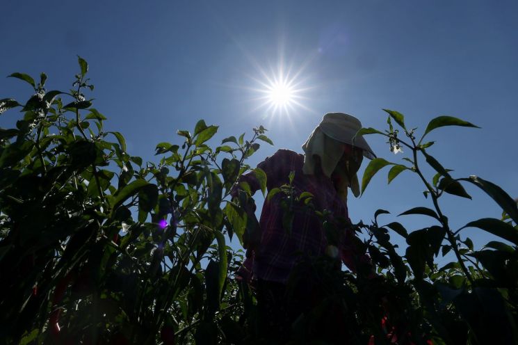
Starting from the afternoon of the 19th, rain will begin in Jeju and the southern coast and spread across various parts of the country until the 22nd. While the daytime heat may ease somewhat, tropical nights will continue. Although some expect the 'magic of Cheoseo'?the cooling of heat as the solar term Cheoseo (處暑) arrives on the 22nd?due to the forecasted rain until then, the Korea Meteorological Administration (KMA) explained that "it is difficult to see this rain as a turning point." There is a high probability that the heatwave will resume once the rain stops.
According to the KMA on the 18th, Tropical Depression No. 17 is currently developing east of Taiwan and is moving northward. A tropical depression is a type of tropical cyclone with maximum sustained winds below 17 m/s. If the maximum sustained winds reach 17 m/s or more, it is classified as a typhoon.
The future path of Tropical Depression No. 17 is uncertain. Tropical depressions and typhoons around the Korean Peninsula move along the edge of the North Pacific High, but the extent of the North Pacific High's reach is highly variable at present. In particular, Tropical Depression No. 18 may form east of No. 17, which would increase the variability of the situation.
Currently, it is likely that Tropical Depression No. 17 will reach the waters near Jeju by the morning of the 20th, then the southern Yellow Sea by the afternoon of the 21st, pass over South Korea, and exit into the East Sea by the morning of the 21st. Due to this, rain will start falling from the afternoon of the 19th in Jeju and the southern coast, with heavy rain expected in Jeju and the southern regions on the 20th, and occasional rain in the central regions.
From the 19th to the 20th, precipitation is expected to be 30?80 mm in Jeju, Busan, Ulsan, and Gyeongnam (with Jeju possibly exceeding 100 mm), 20?60 mm in the southern coast of Jeollanam-do, Daegu, and Gyeongbuk, 10?40 mm in Gangwon Yeongdong and southern Gangwon Yeongseo, 5?40 mm in Honam (excluding the southern coast of Jeollanam-do), 5?30 mm in Chungcheong, and 5?20 mm in the Seoul metropolitan area, the five western islands, central and northern Gangwon Yeongseo, Ulleungdo, and Dokdo. Some areas may experience heavy rain at a rate of about 30 mm per hour, so precautions are necessary.
On the 21st, another low-pressure system approaching from the Shandong Peninsula in China will pass over South Korea, bringing rain nationwide from the afternoon. This rain is expected to continue until the 22nd, and possibly as late as the 23rd.
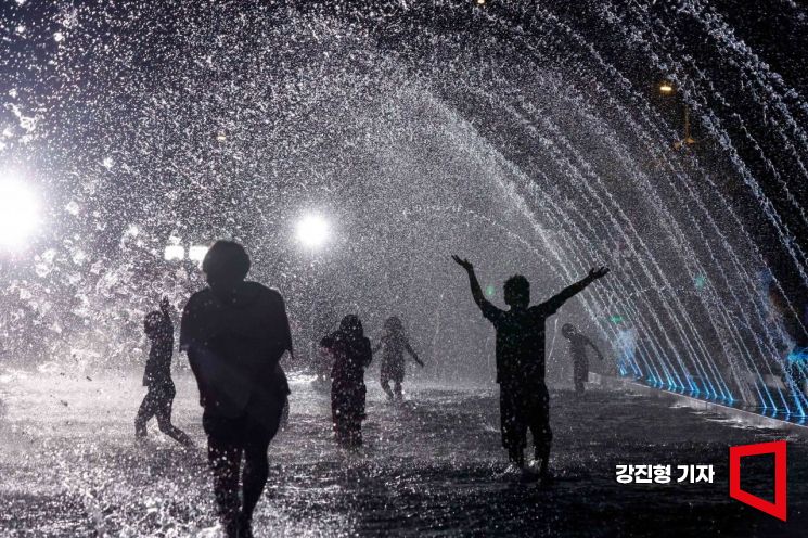 Citizens visiting Yeouido Hangang Park in Seoul are cooling off by playing in the water. Photo by Jinhyung Kang aymsdream@
There is some expectation that the heatwave may ease somewhat with the rain from the 19th to the 22nd. However, since the tropical depression draws in warm air from the south, the heat will intensify before the rain falls, and the temperature drop caused by the rain will be limited. Also, as the rain is expected to fall intermittently rather than continuously, with sunny intervals in between, the heat will not completely dissipate even during rainfall. The KMA stated, "Even with rain, the high temperature will remain above 30 degrees Celsius."
The phenomenon of tropical nights, where the nighttime minimum temperature stays above 25 degrees Celsius due to the continuous inflow of hot and humid air, will also persist. In Seoul, tropical nights have continued for 28 consecutive days as of the 17th, setting a new record for the longest consecutive tropical nights. Busan is also breaking its longest record, currently at 24 days. The total number of tropical nights in Seoul is 31 days, and if tropical nights continue through the night of the 18th, it will match the second-longest record (32 days in 2016). If they continue into next week, the all-time longest record (36 days in 1994) could be surpassed. Busan's total tropical nights so far are 27 days, ranking 10th all-time.
The minimum temperature on the morning of the 19th is forecasted to be between 19 and 26 degrees Celsius, with a maximum daytime temperature of 31 to 36 degrees Celsius. On the 20th, the minimum temperature is expected to be 23 to 27 degrees Celsius, and the maximum temperature 29 to 36 degrees Celsius.
The possibility of the heatwave ending after the rain until Cheoseo on the 22nd is low. Currently, the heat is centered west of the Baekdudaegan mountain range due to easterly winds blowing from a high-pressure system over the East Sea. This East Sea high-pressure system has separated from the main body of the North Pacific High, with Typhoon Ampil (No. 7) passing between them. Once Ampil dissipates, the East Sea high-pressure system and the main North Pacific High will merge, causing South Korea to again be influenced by the North Pacific High.
Some numerical forecast models predict a temperature decline starting on the 23rd, but the scenario gaining more weight is that the hot southwesterly winds traveling over the warm sea along the edge of the North Pacific High will bring back the sweltering heat nationwide.
© The Asia Business Daily(www.asiae.co.kr). All rights reserved.
![Clutching a Stolen Dior Bag, Saying "I Hate Being Poor but Real"... The Grotesque Con of a "Human Knockoff" [Slate]](https://cwcontent.asiae.co.kr/asiaresize/183/2026021902243444107_1771435474.jpg)


