Gyeonggi Province has utilized drones to capture an area of 167㎢, more than 57 times the size of Yeouido, in the first half of this year for use in provincial policy work.
Since 2018, Gyeonggi Province has hired four experts holding ultralight aircraft pilot licenses to form a spatial information drone team within the Land Information Division, supporting policies by capturing drone footage.
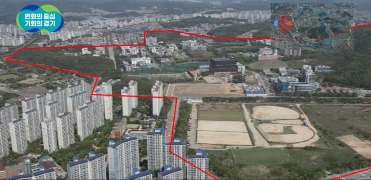
In the first half of this year, Gyeonggi Province used drones to shoot 371 pieces of footage, including 190 videos and 181 orthophotos and 3D images. The main subjects of the footage were ▲ management of project sites such as safety inspections of construction sites during thaw and rainy seasons and steep slopes ▲ promotional materials such as publicity for Hantangang World Geopark and Culture Street ▲ monitoring illegal activities in development-restricted zones and property tax imposition ▲ cadastral work such as analysis of industrial complex development status and cadastral survey inspections ▲ committee review materials. The total area covered was 167㎢.
Gyeonggi Province evaluated that the deployment of drones resulted in a budget saving effect of approximately 1.67 billion KRW.
Ko Jung-guk, head of the Land Information Division of Gyeonggi Province, stated, "We will actively support drone footage for swift and accurate policy decisions," adding, "We will strive to enhance public officials' expertise in drone use by hosting a drone competition organized by Gyeonggi Province in September."
© The Asia Business Daily(www.asiae.co.kr). All rights reserved.
![Clutching a Stolen Dior Bag, Saying "I Hate Being Poor but Real"... The Grotesque Con of a "Human Knockoff" [Slate]](https://cwcontent.asiae.co.kr/asiaresize/183/2026021902243444107_1771435474.jpg)


