"Private Sector Response Not Corrected in 3 Years"
Whenever earthquakes or typhoons occur in Japan, the Japan Meteorological Agency has labeled Dokdo as 'Takeshima (竹島)' on related maps, and this time, the same expression appeared again, raising the need for a strong response at the government level.
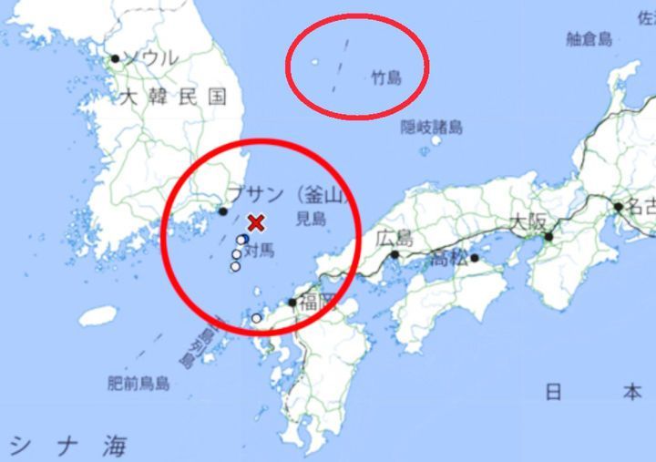 Japan Meteorological Agency earthquake map referring to Dokdo as 'Takeshima (竹島)' and marking it as Japanese territory. [Image source: Provided by Professor Seo Kyung-duk and Sungshin Women's University research team]
On the 21st, Professor Seo Kyung-deok of Sungshin Women's University reported that on the 19th, the Japan Meteorological Agency announced an earthquake of magnitude 3.9 near Tsushima (Daemado), Nagasaki Prefecture, and labeled Dokdo as Japanese territory on the map. Professor Seo said, "Many netizens visit the Japan Meteorological Agency website during earthquake, tsunami, or typhoon warnings, which can instill incorrect perceptions about Dokdo," adding, "Foreign media inevitably pay attention as well, and since many report by capturing the screen of maps provided by the Japan Meteorological Agency, the biggest problem is that it can be mistakenly perceived that 'Dokdo is Japanese territory'." He also added that he has continuously protested this issue for the past three years, but it has still not been corrected.
Professor Seo further stated, "Now the Korean government must strongly respond to the Japan Meteorological Agency," and "At the civilian level, just as we have consistently protested so far, we plan to continue to strongly respond to provocations regarding Dokdo."
In fact, on the 2nd, the Japan Meteorological Agency caused controversy by drawing a dotted line between Ulleungdo and Dokdo and labeling Dokdo as Japanese territory while reporting on an earthquake. In January, when a 'tsunami advisory' was issued, the Noto region of Ishikawa Prefecture, where a maximum magnitude 7.6 earthquake occurred, was marked in purple to indicate the issuance of a 'major tsunami advisory,' and Fukui, Sado, Toyama Prefectures, and others were marked in red to indicate the issuance of a 'tsunami warning.' Hokkaido and Tottori Prefecture were marked in yellow to indicate the issuance of a 'tsunami advisory,' and Dokdo was also colored yellow, including it in the tsunami advisory area. Although the map also showed the Korean Peninsula, Jeju Island, and Ulleungdo, the Japan Meteorological Agency issued a tsunami advisory only for Dokdo.
© The Asia Business Daily(www.asiae.co.kr). All rights reserved.
![Clutching a Stolen Dior Bag, Saying "I Hate Being Poor but Real"... The Grotesque Con of a "Human Knockoff" [Slate]](https://cwcontent.asiae.co.kr/asiaresize/183/2026021902243444107_1771435474.jpg)


