Investigation Maps and Land Information of 875 Private Road Parcels Integrated into a Smart Map for Easy Private Road Identification
Gangnam-gu (District Mayor Jo Seong-myeong) will provide the smart map "Gangnam-gu Private Road Information Service," which allows users to view information about privately owned roads at a glance, through the district's official website starting from the 20th.
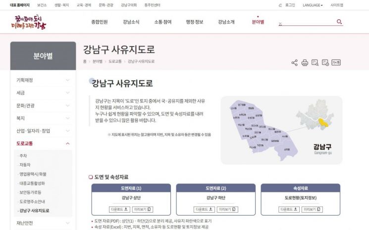
The "Private Road Information Service" is a one-click road information system where users can click on a specific lot number on the map to check road details such as lot number, land category, area, and ownership type (individual, corporation).
The reason this integrated service was necessary is due to various disputes over private roads that have occurred so far. After real estate transactions, disputes over passage rights with landowners may arise if it is not confirmed whether adjacent roads are private. Additionally, during road paving or sewage construction, if the land status is not accurately identified, it can lead to lawsuits over unjust profits. Previously, to check private road information, one had to verify each neighboring parcel and review land information individually, but with the newly established system, this can now be easily confirmed.
Since May, the district formed a dedicated task force to conduct a comprehensive survey of all roads in the district. Out of a total of 4,181 parcels, 875 parcels identified as private roads were extracted, and basic data such as land registers, cadastral maps, land use status, and continuous cadastral maps were investigated. Field surveys were also conducted to organize details such as lot numbers, land categories, and areas. The finalized map information and attribute data (land information, land prices) were integrated and built as public data.
This data can be accessed through the "Gangnam-gu District Office Website → By Category → Roads and Traffic → Private Roads" menu. Users can click on the map on the web to immediately check the details, and can also download computerized maps in PDF format and land attribute information organized in Excel files.
Through this proactive administration, the district plans to support current maps for various construction projects in the future to prevent civil complaints in advance. It is also expected to reduce the need for document review and issuance to verify land information during real estate transactions and construction.
Jo Seong-myeong, Mayor of Gangnam-gu, said, "For the establishment of this system, our staff spent the past five months compiling data and thoroughly organizing the current status by visiting sites in person, demonstrating proactive administration by providing it as public data. We will continue to work with an attitude of proactively identifying and resolving inconveniences experienced by residents."
© The Asia Business Daily(www.asiae.co.kr). All rights reserved.
![Clutching a Stolen Dior Bag, Saying "I Hate Being Poor but Real"... The Grotesque Con of a "Human Knockoff" [Slate]](https://cwcontent.asiae.co.kr/asiaresize/183/2026021902243444107_1771435474.jpg)


