Super Typhoon 'Mawar' Hits Guam Causing Widespread Damage
"Strong Winds So Severe Trees Were Uprooted"
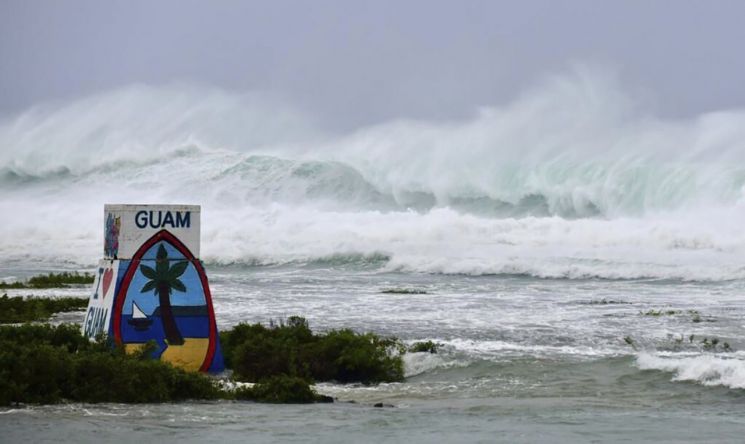
Typhoon Mawar, a Category 4 storm accompanied by winds reaching up to 225 km/h and heavy rainfall, struck Guam, a premier Pacific vacation destination. The typhoon caused widespread damage, with cars being blown away and trees uprooted in various locations.
The U.S. National Weather Service reported that Category 4 Typhoon Mawar, known as a "super typhoon," recorded a maximum rainfall of up to 500 mm per hour overnight. This is the first time since 2002's Typhoon Pongsona that a Category 4 typhoon has hit Guam.
There have been no reports of deaths or injuries so far, but some houses and structures were damaged by strong winds, and a curfew was imposed in the city. Additionally, flights to and from Guam were canceled, leaving Korean tourists and residents stranded.

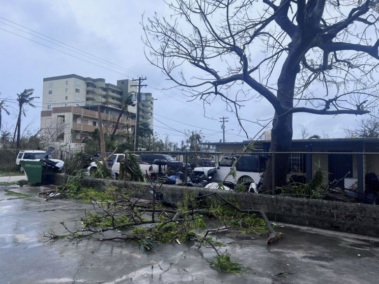
Posts on online communities also continued to report typhoon damage experienced during trips to Guam. One netizen wrote on a Guam travel-related online community, "I came to Guam for a golf trip, but Typhoon Mawar is scary," adding, "A typhoon in May is really unexpected, so I’m anxious and scared. I just pray it passes safely." They also added, "The wind is so strong that trees are being uprooted."
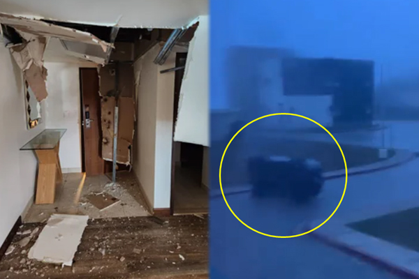
Furthermore, a five-star resort in Guam was turned into a scene of chaos as the ceiling and doors were torn off by Mawar. Another netizen shared photos on an online community showing the resort’s ceiling ripped off and debris scattered on the floor, expressing concern by saying, "I worry if the guests staying here are safe."
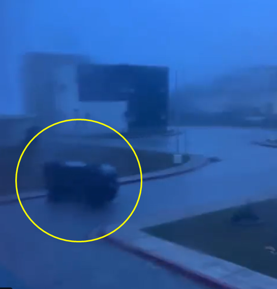
Meanwhile, a video showing cars being blown away by the typhoon went viral on social media. The netizen who posted the video said, "Most vehicles were flooded, and windows were shattered by the wind."
The typhoon caused power outages in a significant number of buildings. Although there were no casualties, some residents were urgently rescued after their homes were damaged. It was also reported that weather observation equipment was destroyed.
Meanwhile, Typhoon Mawar is moving westward toward the eastern waters of the Philippines. There is a possibility it will move further north from northern Philippines toward southern Taiwan.
According to the typhoon advisory issued by the Korea Meteorological Administration at 10 a.m. on the 25th, Typhoon Mawar, currently at a "very strong" level, is expected to head toward the waters east of Manila, Philippines, and intensify to an "ultra-strong" level by the 26th.
It is expected to maintain the "ultra-strong" level until the 28th, then weaken back to "very strong" around the 29th. At that time, Typhoon Mawar is predicted to be located between Taiwan and the Philippines, south of the Okinawa Islands.
© The Asia Business Daily(www.asiae.co.kr). All rights reserved.
![Clutching a Stolen Dior Bag, Saying "I Hate Being Poor but Real"... The Grotesque Con of a "Human Knockoff" [Slate]](https://cwcontent.asiae.co.kr/asiaresize/183/2026021902243444107_1771435474.jpg)


