Southern Gyeongbuk, Gyeongnam Region, Jeju Island 5~40mm
Southern Jeonnam 60mm or more
Stationary front reactivates around the 14th
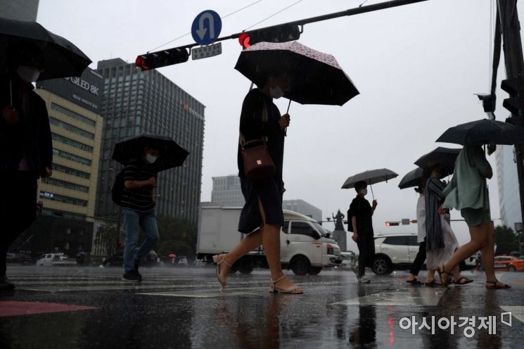 On the 11th, when it rained, citizens hurried on their way to work at Gwanghwamun Intersection in Jongno-gu, Seoul. / Photo by Moon Honam munonam@
[Asia Economy Reporter Han Jinju] Rain is expected to fall in the southern regions until Friday morning, the 12th, and the stagnant front is likely to move away from the area starting in the afternoon. Rain will continue to fall across various parts of the country over the weekend due to the influence of a low-pressure trough.
According to the Korea Meteorological Administration, rain will fall in the Jeolla region, southern Gyeongbuk region, and Gyeongnam region until the morning, and in Jeju Island until the afternoon, with amounts ranging from 5 to 40mm. In the Jeonnam region, during the morning rush hour, there will be gusty winds and thunder accompanied by more than 60mm of rain.
On the 13th, due to the influence of a low-pressure trough located over the West Sea, rain will begin in the Chungnam region and Jeolla region from the morning and will expand nationwide except for the East Coast by the afternoon. Rain will continue until night in the central regions and northern inland Gyeongbuk. Expected precipitation amounts are 10 to 60mm in the Seoul metropolitan area, Gangwon Yeongseo, and northern Chungcheong region, and 5 to 30mm in southern Chungcheong, southern regions, Jeju Island, and the five West Sea islands.
On the 14th, some areas in the central regions will experience rain until the afternoon. Rain will cease in the Gyeongbuk region in the morning, but some areas in northern Gyeonggi and central to northern Gangwon will have rain continuing until night.
A stagnant front will develop around northern China and the Korea-China border around the 14th, bringing heavy rain mainly to the central regions from the night of the 15th through the 16th. The amount of rain is expected to be as heavy as that on the 8th. The central regions will be affected on the 15th and 16th, and the southern regions from the 17th onward.
From the 12th, heatwaves and tropical nights will intensify again. The inland southern Chungcheong region, southern regions, and Jeju Island will experience maximum apparent temperatures around 33 to 35 degrees Celsius. Tropical nights will be frequent, especially in the southern regions and Jeju Island. The highest daytime temperatures on the 12th are expected to be between 29 and 34 degrees Celsius, and on the 13th between 27 and 34 degrees Celsius. During the rain on the 13th, temperatures will temporarily drop but will rise again afterward with increased humidity.
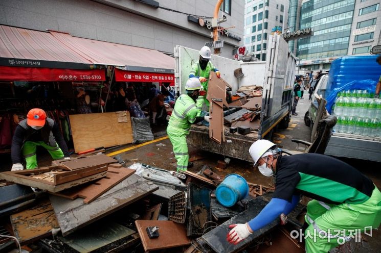 On the 10th, as heavy rain poured over the central region including the Seoul metropolitan area, causing numerous casualties and property damage, volunteers and military personnel, along with merchants affected by flooding at Namseong Sagye Market in Dongjak-gu, Seoul, are carrying out restoration work. Photo by Kang Jin-hyung aymsdream@
Most weather warnings have been lifted in most areas, but over 600mm of rain fell in the Seoul metropolitan area and surrounding regions from the 8th until 5 a.m. on the 12th. Recorded amounts include 643mm in Gwangju (Jiwol), Gyeonggi Province, 641mm in Yangpyeong (Yongmunsan), Gyeonggi Province, 577.5mm at the Korea Meteorological Administration (Dongjak-gu, Seoul), and 338.9mm in Bupyeong, Incheon.
As the stagnant front moved southward, heavy rain also fell in the Chungcheong region and southern Gyeonggi. From the 11th to the 12th, precipitation amounts recorded were 193.5mm in Gunsan, Jeonbuk, 154.4mm in Boryeong, Chungnam, 123.9mm in Iksan, Jeonbuk, and 113mm in Yongin (Cheoin Yeoksam), Gyeonggi Province.
© The Asia Business Daily(www.asiae.co.kr). All rights reserved.
![Clutching a Stolen Dior Bag, Saying "I Hate Being Poor but Real"... The Grotesque Con of a "Human Knockoff" [Slate]](https://cwcontent.asiae.co.kr/asiaresize/183/2026021902243444107_1771435474.jpg)


