Launch of 4 CubeSats Begins at Two-Day Intervals on the 29th
Success Announcement of Chosun University-Made Satellite on the Morning of the 30th
[Asia Economy Reporter Kim Bong-su] On the 21st, South Korea's first indigenous space launch vehicle, 'Nuriho,' which successfully completed its second launch, is entering its final mission. The task of deploying cube satellites made by university students, the 'space dreamers,' aboard the performance verification satellite and placing them into orbit is beginning.
According to the Korea Aerospace Research Institute (KARI) on the 29th, the Nuriho performance verification satellite, currently orbiting at an altitude of 700 km around the Earth, will start ejecting four cube satellites installed inside at two-day intervals from the afternoon of the same day to place them into orbit.
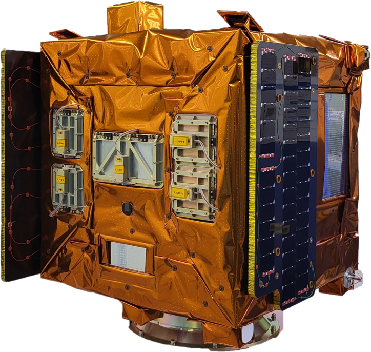
In order, ▲Chosun University’s STEP Cube Lab-Ⅱ will be launched first, followed by ▲Korea Advanced Institute of Science and Technology (KAIST) RANDEV on July 1, ▲Seoul National University’s SNUGLITE-Ⅱ on July 3, and ▲Yonsei University’s MIMAN on July 5, each heading to space.
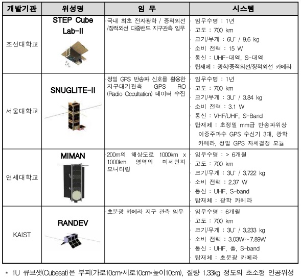
Chosun University’s 'STEP Cube Lab-Ⅱ' monitors thermal changes around the Korean Peninsula using visible and infrared light. It especially keeps watch over Baekdusan Cheonji, where explosion risks have been raised. Chosun University will attempt first communication with STEP Cube Lab-Ⅱ around 2 a.m. on the 30th to confirm success. The Ministry of Science and ICT will announce the success of the cube satellite deployment and communication results at 9 a.m. the same day.
Seoul National University’s 'SNUGLITE-Ⅱ' is an Earth atmosphere observation satellite utilizing precise GPS carrier signals. Yonsei University’s 'MIMAN' monitors fine dust at a resolution of 200 meters, while KAIST’s 'RANDEV' carries out Earth observation missions using a hyperspectral camera.
© The Asia Business Daily(www.asiae.co.kr). All rights reserved.
![Clutching a Stolen Dior Bag, Saying "I Hate Being Poor but Real"... The Grotesque Con of a "Human Knockoff" [Slate]](https://cwcontent.asiae.co.kr/asiaresize/183/2026021902243444107_1771435474.jpg)


