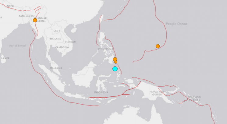
 A magnitude 6.0 earthquake occurred near the northern sea area of Sulawesi Island, Indonesia (blue dot).
 [Photo by US Geological Survey (USGS) website capture]
[Asia Economy Reporter Junhyung Lee] The European-Mediterranean Seismological Centre (EMSC) reported that a magnitude 6.0 earthquake occurred on the morning of the 22nd at 10:26 AM (local time) in the northern offshore area of Sulawesi Island, Indonesia.
The epicenter was observed to be 317 km north-northeast of Manado on Sulawesi Island and 240 km southeast of Sarangani on Mindanao Island, Philippines. The focal depth was approximately 49 km.
The United States Geological Survey (USGS) also reported the earthquake's magnitude as 6.0. The focal depth observed by USGS was about 24 km.
Xinhua News Agency reported that no tsunami warning was issued due to this earthquake. Indonesia is located on the Pacific Ring of Fire, where earthquakes and volcanic eruptions frequently occur.
© The Asia Business Daily(www.asiae.co.kr). All rights reserved.


