Rain begins from the Seoul Metropolitan Area, Chungnam Region, and Jeju... Rain in the Seoul Metropolitan Area until afternoon
Fine dust levels 'Bad' in Seoul, Gyeonggi-do, and Jeonbuk in the morning
Dense fog in the tunnel crossing the Taebaek Mountains, caution advised for collision accidents
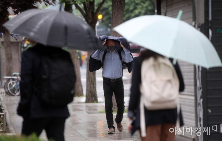 On the 1st, rain fell in various parts of the central region. Near Gwanghwamun in Seoul, a commuter who was unprepared with an umbrella hurried along the street, covering themselves with an outer garment. Photo by Hyunmin Kim kimhyun81@
[Asia Economy Reporter Han Jinju] On Tuesday the 15th, the entire country will be cloudy, with rain starting from the Seoul metropolitan area, Chungnam region, and Jeju Island, then spreading to other areas.
The Korea Meteorological Administration forecasted that rain will begin in the early morning in the Seoul metropolitan area, Chungnam region, and Jeju Island, expanding to all areas except inland Gangwon by morning. Rain in the Seoul metropolitan area will stop in the afternoon, and in the Chungcheong region at night.
In particular, Jeju will experience strong rain exceeding 20mm per hour between noon and evening due to the inflow of hot and humid air.
Expected precipitation until the 16th is ▲Jeju (excluding northern and western parts) 30?80mm ▲South coast of Jeonnam 20?60mm ▲Incheon, western coast of Gyeonggi, Jeonnam region (excluding south coast), Gyeongnam region, northern and western Jeju 10?40mm ▲Seoul metropolitan area, Gangwon Yeongdong, Chungcheong region, Jeonbuk, Gyeongbuk region, the five western islands, Ulleungdo and Dokdo 5?20mm.
Daytime temperatures will remain around 25 degrees Celsius. On the 16th, temperatures are expected to rise by 2?5 degrees to around 30 degrees Celsius. Fine dust levels will be temporarily 'bad' in Seoul, Gyeonggi Province, and Jeonbuk in the morning due to stagnant air in the western regions, while other areas will range from 'normal' to 'good'.
As the east wind continues, dense fog with visibility below 200 meters will form in the Gangwon mountain area, requiring caution for traffic safety. The Korea Meteorological Administration advised, "When driving through tunnels crossing the Taebaek Mountains toward the East Coast, visibility can suddenly decrease sharply. Please maintain sufficient distance between vehicles and reduce speed to prevent rear-end collisions and other accidents."
From this day until the morning of the 16th, there will be places with thunder and lightning accompanied by gusts in the southern waters of the West Sea, southwestern waters of the South Sea, and the seas around Jeju Island. Winds will blow very strongly at 10?16 meters per second in the southern waters of the West Sea, the South Sea, and the seas around Jeju Island until the 17th, with waves rising 2?4 meters high.
© The Asia Business Daily(www.asiae.co.kr). All rights reserved.
![Clutching a Stolen Dior Bag, Saying "I Hate Being Poor but Real"... The Grotesque Con of a "Human Knockoff" [Slate]](https://cwcontent.asiae.co.kr/asiaresize/183/2026021902243444107_1771435474.jpg)


