Bucheon City, Gyeonggi Province, announced on January 6 that it has established implementation plans for the cadastral re-survey projects in the Yakdae 1 District and Naedong 2 District, and is currently conducting an online briefing session for residents.
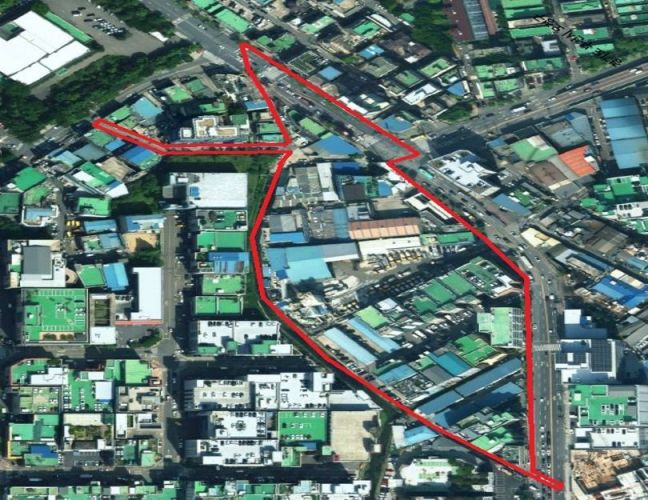
The cadastral re-survey project is a national policy initiative aimed at correcting discrepancies between the actual land status and the registered information in cadastral records, as well as converting paper-based cadastral maps to digital formats. This year, Bucheon City has selected Yakdae 1 District (around 153-13 Yakdae-dong) and Naedong 2 District (around 101-1 Naedong) as project sites, covering 141 parcels of land (98,791 square meters) for full-scale implementation.
Accordingly, the city is holding online briefing sessions to enhance residents' understanding while establishing the implementation plan. The heads of Wonmi District Office and Ojeong District Office, as project operators, must obtain the consent of more than two-thirds of landowners and apply for the designation of the project area to the Land Information Division at Bucheon City Hall.
The online briefing session, which includes an overview of the cadastral re-survey project and the current status of the project areas, has been produced as a video and posted on the "Bucheon City Cadastral Re-survey" YouTube channel. Anyone can watch it via a QR code.
For landowners and elderly residents who may have difficulty accessing the online session, the city also plans to operate in-person briefing sessions that visit local communities.
A Bucheon City official stated, "The cadastral re-survey project plays an important role in reducing land boundary disputes, protecting property rights, and increasing land value," adding, "We ask for the active participation and cooperation of residents to provide accurate land information."
© The Asia Business Daily(www.asiae.co.kr). All rights reserved.


