Unusually Low Temperatures in San Francisco During June and July
Oakland Experiences a "Colder Summer" Than February
Few Days Over 30 Degrees in LA... Eyes on August
While severe heat waves are sweeping across many parts of the world, the western coastal region of the United States is reportedly experiencing an unusually "cold summer." Yonhap News reported on the 27th (local time) that "the San Francisco Bay Area office of the US National Weather Service (NWS) announced on X (formerly Twitter) that this region recorded historically low daily high temperatures for June and July this year."
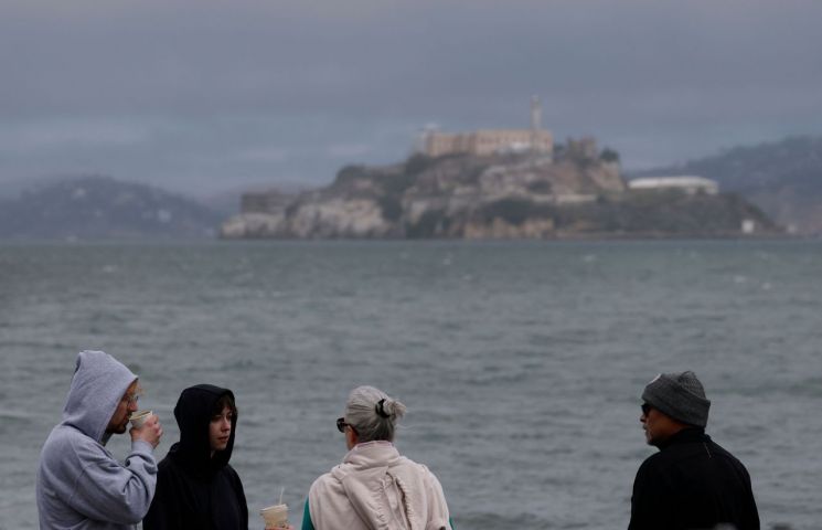 On the 22nd, visitors in San Francisco wore hooded zip-up jackets in the cold weather. Photo by Getty Images Yonhap News
According to the NWS, the average temperature in downtown San Francisco in July was 15.2 degrees Celsius, and the average temperature in San Jose was 19.7 degrees Celsius. The last cold summer in downtown San Francisco was in 1982, while for San Francisco International Airport, it was in 1965. In other words, this summer, downtown San Francisco recorded the lowest average daily high temperature in 43 years, and San Francisco International Airport in 60 years. In southern San Jose, where many Korean Americans live, this was the lowest temperature in 26 years since 1999.
In Oakland, located in the eastern part of the San Francisco Bay Area, the temperature exceeded 23.9 degrees Celsius only once this month. Compared to the three such days in February, this summer has been colder than last winter.
Meteorologist Matt Mehle told the LA Times that "the seasonal high-pressure system, which usually brings hot weather to California, is positioned somewhat differently this year and is located farther west than usual." He explained, "As a result, a low-pressure system has remained almost stationary over the Pacific Northwest and California, leading to persistent cloud cover and lower temperatures."
This weather is expected to continue for the time being. The LA Times reported that "tourists visiting the region are spending extra money buying jumpers and scarves due to the unexpectedly chilly midsummer weather."
Even in Los Angeles, temperatures have remained much milder than last summer. Although there were a few days in mid-June when temperatures exceeded 30 degrees Celsius, there have been very few days this month when the temperature surpassed 30 degrees. In typical years, inland areas of Los Angeles would have seen temperatures exceeding 40 degrees on several occasions. However, meteorologists have warned that "summer is not over yet," and people should be prepared for the possibility of temperatures rising again starting in August.
Currently, a heat advisory has been issued for the northeastern United States. In some parts of New York, the highest temperature reached 30 degrees Celsius the previous day, and the heat index rose to around 38 degrees. In the southeastern region, there are areas where the perceived temperature is expected to exceed 46 degrees.
This heat wave is believed to be caused by the so-called "heat dome phenomenon." This meteorological event occurs when a high-pressure system remains stationary over a region for an extended period, trapping hot air near the surface, and has been causing extreme heat across the United States since early summer.
© The Asia Business Daily(www.asiae.co.kr). All rights reserved.


