Gijang County (Governor Jung Jongbok) is actively deploying drones (unmanned aerial vehicles) for land characteristic surveys to determine individual publicly announced land prices, thereby enhancing both work efficiency and accuracy.
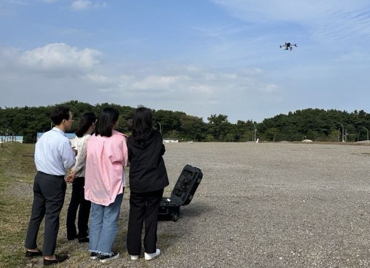
The county is conducting land characteristic surveys until July 25 for the "second half individual land price assessment based on July 1." The survey covers approximately 920 parcels of land that experienced changes in the first half of this year. In particular, drones are being used to survey areas with difficult terrain or where vehicle access is limited, allowing for aerial inspection.
Previously, surveys required on-site visits, but drones can cover large areas from the air in a short period of time, significantly reducing both time and manpower. Additionally, the county explained that drones enable real-time confirmation of project site locations and surrounding topography, which facilitates the construction of a spatial information database (DB).
Notably, vertical aerial photographs taken by drones are used to create orthophotos (images aligned without distortion), which can then be overlaid with cadastral maps and urban planning lines for more precise analysis. This represents an evolution from simple "visual field surveys" to "data-driven spatial analysis."
Jung Jongbok, Governor of Gijang County, emphasized, "Individual publicly announced land prices are a critical issue directly related to residents' property rights. We will actively adopt the latest technologies, such as drones and aerial imaging, to enhance the fairness and reliability of land administration."
Gijang County has also laid a solid foundation for drone utilization. County employees have personally obtained "ultralight aircraft operator licenses" to directly operate drones and produce aerial images, proactively integrating digital technology into public administration.
© The Asia Business Daily(www.asiae.co.kr). All rights reserved.


