Detailed Maps by Town, Township, and Neighborhood, Including Harbor and Anchorage Map for Marine Use... Files Available on City Website
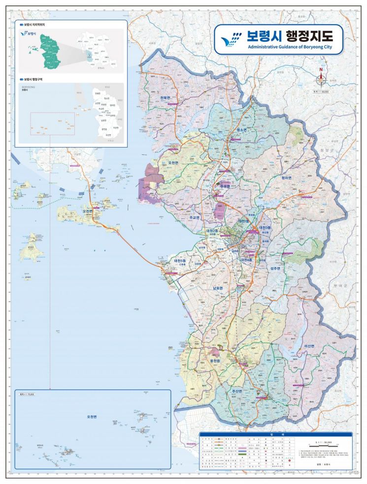
Boryeong City in South Chungcheong Province announced on July 11 that it has newly produced two-sided administrative maps in 13 different types, aiming to improve citizens' access to spatial information and to provide foundational data for administrative planning.
The city has completely revamped the previous single-type, two-sided administrative map produced in 2021. The new version features a map of Boryeong City on the front, and on the back, it includes 12 types of maps for each town, township, and neighborhood, as well as one harbor and anchorage map, making a total of 13 types across both sides.
This allows the city to provide more practical and highly usable data by administrative district.
In particular, the newly added harbor and anchorage map is expected to be of practical help for maritime traffic and administrative tasks related to the sea off Boryeong.
A city official stated, "The previous administrative map had limitations in identifying the characteristics of each region, but this new map can contribute to providing customized administrative services for each town, township, and neighborhood," adding, "We will continue to do our best to provide spatial information that meets the needs of our citizens."
© The Asia Business Daily(www.asiae.co.kr). All rights reserved.


