Eliminating Location Information Blind Spots
On June 24, Gwangsan-gu in Gwangju announced that it has assigned road names to the Eodeungsan Trail and the Jangsu First Underpass in an effort to eliminate location information blind spots.
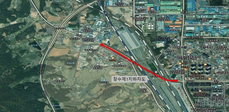 Location map of Jangsu First Underpass connecting Jangsu Intersection in Gwangsan-gu, Gwangju to Hanam-daero. Provided by Gwangsan-gu
On this day, following a review by the Address Information Committee, Gwangsan-gu assigned road names to two sections: the Eodeungsan Trail (Song-san Recreation Area to Bomun High School, base numbers 1 to 570) and the Jangsu First Underpass (Jangsu Intersection to Hanam-daero, base numbers 1 to 82). Previously, road names were only given to surface roads, but the scope has now been expanded to include mountain trails and three-dimensional roads such as underpasses.
By establishing a systematic address system in areas where the lack of road names made it difficult to determine locations, it is now possible for hikers to request rescue quickly in case they get lost or in emergency situations such as disasters. Park Byungkyu, head of Gwangsan-gu, stated, "Eliminating location information blind spots will enhance citizen safety," and added, "We will continue to expand the address information infrastructure."
© The Asia Business Daily(www.asiae.co.kr). All rights reserved.


