Starting from Jeju Island on the 12th, expanding nationwide
Typhoon Ewiniar may affect precipitation
Monsoon in central regions expected in late June... Heavy rain and heatwaves likely to increase
The third earliest monsoon season on record has begun. Starting from Jeju Island on the 12th, rain is expected to expand to the Chungcheong, Jeolla, and Gyeongsang regions on the 13th, and to most areas nationwide on the 14th, which falls on the weekend. The first typhoon of the year has also formed and may have an impact.
According to the Korea Meteorological Administration on the 12th, rain is expected in Jeju Island on this day due to the influence of a stationary front. From the 13th to the 14th, precipitation is expected to expand nationwide as water vapor flows in from the sea east of the Philippines.
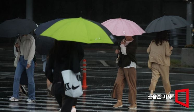 Starting from Jeju Island on the 12th, precipitation is expected to expand nationwide on the 13th and 14th. Photo shows the Yeouido area in Seoul. Photo by Jo Yongjun
The average start date of the monsoon season in Jeju is June 19, meaning this year's monsoon in the region has arrived a week early. In Kagoshima, Japan, where the monsoon has already begun, heavy downpours have brought 200 to 300 millimeters of rain. Starting from the 14th, rain is expected in most regions nationwide, including the Seoul metropolitan area and Gangwon. However, rain outside of Jeju Island is not expected to be officially considered the 'start of the monsoon.' The key factor in defining the monsoon is whether the rain is caused by a stationary front. There is also a possibility of heavy rain on the 15th and 16th.
The first typhoon of the year, 'Ewiniar,' has also formed. Ewiniar, which originated west of the Philippines, is slowly moving north and is expected to make landfall in southern China around the 14th. Although it is expected to dissipate after the 15th, if large amounts of water vapor are carried by the steering flow into Korea, it could affect precipitation levels.
The government expects the main monsoon period this year to be in late June, similar to the average year. The average start dates for the monsoon in the southern and central regions are June 23 and June 25, respectively. However, the likelihood of sudden heavy rains and heatwaves caused by climate change is increasing. The reason is the high sea surface temperatures in the tropical western Pacific that have continued since spring. If high sea surface temperatures persist in the tropical western Pacific, convective activity intensifies, forming descending air currents over East Asia and developing high pressure to the southeast of Korea. When high pressure forms, the inflow of hot and humid air increases.
To prepare for the monsoon, the government has activated 'flood damage prevention measures.' Authorities are re-examining areas previously affected by flooding to establish countermeasures to prevent recurrence, and plan to focus on intensive management to prevent damage caused by carelessness or indifference. For vulnerable areas and facilities, priority will be given to rapid control, evacuation of residents, and other measures to protect lives.
© The Asia Business Daily(www.asiae.co.kr). All rights reserved.


