The cold weather that has continued since this week is expected to persist through the weekend.
According to the Korea Meteorological Administration on the 21st, a cold wave warning will be issued from the 22nd to the 23rd, mainly affecting northern and eastern Gyeonggi, inland and mountainous areas of Gangwon, central inland Chungnam, Chungbuk, and northern inland and northeastern mountainous areas of Gyeongbuk. Morning temperatures are forecasted to be around minus 10 degrees Celsius (around minus 15 degrees Celsius in some inland and mountainous areas of Gangwon and northeastern mountainous areas of Gyeongbuk).
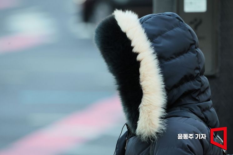 On the 3rd, the day of 'Ipchun,' which marks the beginning of spring according to the solar calendar, citizens passing through Gwanghwamun Intersection in Seoul hurried their steps, tightly bundling up their bodies. This morning, the perceived temperature in Seoul dropped to as low as minus 13 degrees Celsius, significantly lower than the average. Photo by Yoon Dong-ju
Additionally, strong winds will make the wind chill temperature even lower. For the time being, temperatures are expected to be lower than the average (lowest between minus 7 to minus 2 degrees Celsius, highest between 5 to 11 degrees Celsius).
On the morning of the 22nd, the lowest temperature is forecasted to be between minus 12 to minus 1 degrees Celsius, and the highest temperature during the day will be between 0 to 7 degrees Celsius. On the morning of the 23rd, the lowest temperature is expected to be between minus 12 to minus 2 degrees Celsius, and the highest temperature during the day will range from minus 1 to 5 degrees Celsius.
This cold spell is expected to subside around early next week, returning to average temperatures. Afterward, mild weather is forecasted to continue.
On the 22nd, the whole country will be mostly clear, with occasional clouds in southern Gyeonggi, Chungcheong, Jeolla regions, and western inland Gyeongnam. On the 23rd, the country will generally be clear, but Chungnam, Jeolla regions, and Jeju Island will be mostly cloudy.
In some inland areas where snow has accumulated, the snow that melted during the day will refreeze overnight as temperatures drop, causing icy roads and black ice, making many places slippery. The Korea Meteorological Administration has advised caution for safety accidents as the ice may thin and break due to melting during the day.
For the time being, strong winds with gusts around 55 km/h (around 70 km/h in mountainous areas) will blow in most parts of the country. In the southern offshore waters of Jeju Island, where a high seas warning has been issued, winds will blow strongly at 35 to 60 km/h until early morning on the 22nd, with waves rising 1.5 to 3.5 meters high.
On the east coast, high waves caused by swell will wash onto sandy beaches and may overflow breakwaters or coastal roads. The Korea Meteorological Administration has warned to be cautious of safety accidents.
© The Asia Business Daily(www.asiae.co.kr). All rights reserved.


