Bucheon City in Gyeonggi announced on the 23rd that Chunui District, Okgil 2 District, and Naedong District have been designated and officially announced as cadastral resurvey project districts for 2024 after review by the city’s Cadastral Resurvey Committee.
Accordingly, the city will carry out cadastral resurvey for ▲Chunui District (around 70-1 Chunui-dong) with 46 parcels (48,858.2㎡), ▲Okgil 2 District (around 525-2 Okgil-dong) with 42 parcels (20,878㎡), and ▲Naedong District (around 222-21 Naedong) with 49 parcels (76,712㎡).
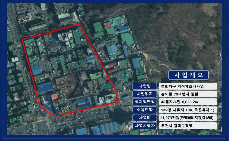
The cadastral resurvey project involves converting paper cadastral maps created during the Japanese colonial period into digital cadastral maps to correct registration details in the cadastral records that do not match the actual land conditions. This aims to resolve land boundary disputes, protect citizens’ property rights, and enhance land utilization for efficient national land management.
Bucheon City has so far established implementation plans for the respective areas, held resident briefings, conducted field surveys, and designated the cadastral resurvey project districts after obtaining consent from at least two-thirds of landowners and area.
The city plans to complete the project within this year, including cadastral resurvey measurements and boundary confirmation through boundary agreements.
© The Asia Business Daily(www.asiae.co.kr). All rights reserved.
![Clutching a Stolen Dior Bag, Saying "I Hate Being Poor but Real"... The Grotesque Con of a "Human Knockoff" [Slate]](https://cwcontent.asiae.co.kr/asiaresize/183/2026021902243444107_1771435474.jpg)


