'KSAT3U' Soars to Space Aboard Nuri Rocket
Shows Snow-Covered Baekdusan and Unfrozen Cheonji
Captured Korean Peninsula Area Last August as Well
In May, a domestic CubeSat launched into space aboard the Korean launch vehicle Nuri sent back images of the area around Baekdusan Cheonji, which had not frozen over.
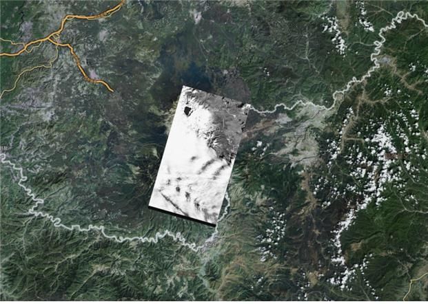 A map of the Baekdusan area overlaid with a satellite image taken by Kairospace Cube Satellite 'KSAT3U'. [Photo by Kairospace]
According to Kairospace on the 20th, the CubeSat 'KSAT3U' developed by the company captured images of the Baekdusan Cheonji area on the 3rd and transmitted them to the ground station. Although the Baekdusan area was covered with snow due to heavy snowfall, Cheonji was still observed to be unfrozen.
The video was taken in black and white from an altitude of 540 km, covering an area 57 km wide and 32 km long. The resolution is sufficient to distinguish objects about 30 meters in size.
KSAT3U is a 3-unit satellite (1 unit measures 10 cm in width, length, and height) weighing 2.86 kg, developed with the goal of observing weather phenomena by capturing the Earth's surface using polarization. It is equipped with a 22mm polarization camera used for this video capture.
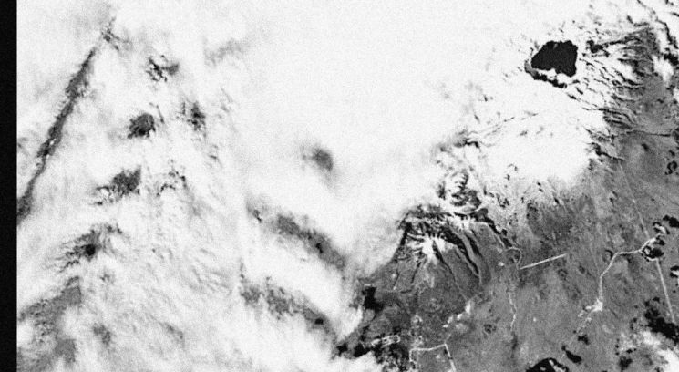 The Baekdusan Cheonji lake photographed by Kairospace Cube Satellite 'KSAT3U' on the 3rd. The Baekdusan area appears white due to snowfall, but Cheonji (top right) clearly shows an unfrozen state.
 [Photo by Kairospace]
Shin Kyung-woo, CEO of Kairospace, explained, "The video was taken from Suwon to Baekdusan with a camera smaller than a 100-won coin," and said the satellite is still functioning well.
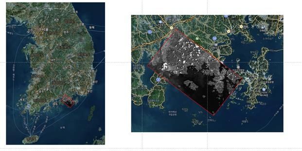
Meanwhile, KSAT3U also succeeded in its mission last August to capture and send clear images of the Korean Peninsula's surface. At that time, it was the first time a domestically developed CubeSat captured and transmitted images of the Earth.
Originally targeting Typhoon Khanun (the 6th typhoon), the satellite captured images of the Sacheon and Tongyeong areas before the typhoon made landfall as Khanun's path shifted toward Japan.
The video clearly showed the complex coastline and islands of the southern coast, and when overlaid on maps, the images matched precisely.
© The Asia Business Daily(www.asiae.co.kr). All rights reserved.
![Clutching a Stolen Dior Bag, Saying "I Hate Being Poor but Real"... The Grotesque Con of a "Human Knockoff" [Slate]](https://cwcontent.asiae.co.kr/asiaresize/183/2026021902243444107_1771435474.jpg)


