US Commercial Satellite Company Maxar Releases Satellite Images
Satellite images showing the damage caused by the Category 4 "Super Typhoon" Mawar, which struck the U.S. territory of Guam, have been released.
According to major foreign media on the 26th (local time), the U.S. commercial satellite company Maxar recently released satellite images showing the situation in Guam before and after Mawar's approach.
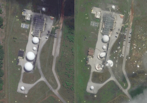 Satellite image of NASA remote ground terminal located in Dededo area, Guam, a U.S. territory, released by U.S. commercial satellite company Maxar on the 26th (local time). Photo by AP
The remote ground terminal of NASA (National Aeronautics and Space Administration) located in the Dededo area of Guam also suffered significant damage.
Of the three large radomes installed around to protect the radar, two were damaged, and one of the radars enclosed by the radomes appears to have collapsed. The photos show debris scattered messily around the area.
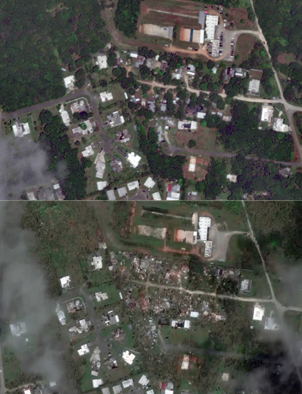 Satellite images of Guam before and after the typhoon, released on the 26th (local time) by the U.S. commercial satellite company Maxar. Photo by AP Yonhap News
The residential areas in Guam are equally devastated. Houses were destroyed, and trees were broken, exposing the ground. The straight roads are cluttered with debris.
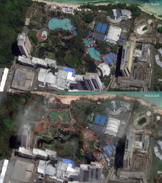 A resort in Dededo, Guam, as seen in satellite images released on the 26th (local time) by the American commercial satellite company MAXAR. Photo by AP Yonhap News
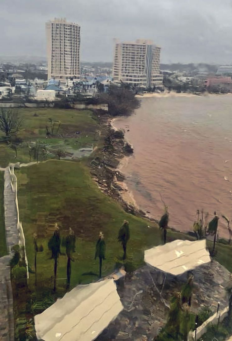
The resort hotels where tourists stay have also lost all vitality. The parasols and sunbeds that lined the nearby beach have disappeared, and the once cool blue swimming pools no longer look the same.
Mawar, which passed through Guam on the 24th and 25th, was a Category 4 super typhoon and recorded as the strongest typhoon to approach Guam in decades.
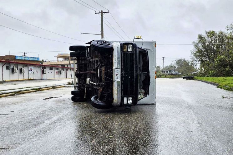
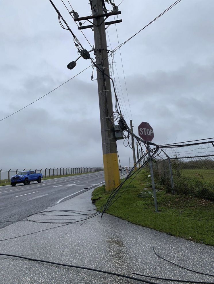
Fortunately, there were no fatalities, but the strong winds exceeding 240 km/h knocked down utility poles, causing power outages and suspending water and sewage services, resulting in inconvenience for residents.
The Guam airport authorities issued a press release on the morning of the 27th (local time), announcing the opening of some runways for humanitarian aid and essential cargo transport.
If restoration proceeds as planned, commercial passenger services could resume as early as the 30th of this month, and discussions with airlines regarding related plans are underway.
According to the Juhaganya Office, the Korean diplomatic mission in Guam, approximately 3,200 Korean tourists have been identified as unable to return home due to the impact of Mawar.
© The Asia Business Daily(www.asiae.co.kr). All rights reserved.
![Clutching a Stolen Dior Bag, Saying "I Hate Being Poor but Real"... The Grotesque Con of a "Human Knockoff" [Slate]](https://cwcontent.asiae.co.kr/asiaresize/183/2026021902243444107_1771435474.jpg)


