8th Busan Future Innovation Meeting Hosted by Mayor Park Hyung-jun at City Hall on the 13th at 9 AM
Urban Flood Prediction Map ... Flood Risk Information, Optimal Evacuation Routes, Control Status, Flood History, etc.
Disaster Maps, On-site
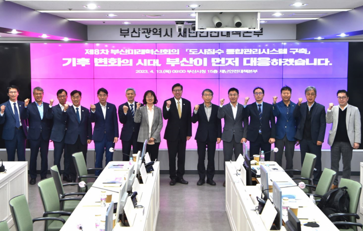
On the 13th at 9 a.m., Busan City held the 8th Busan Future Innovation Meeting, chaired by Mayor Park Hyung-jun, at the Disaster and Safety Countermeasures Headquarters on the 15th floor of Busan City Hall. The meeting simulated an urban flooding disaster scenario to demonstrate the ‘Urban Flooding Integrated Management System’ and discussed its specific applications and future development directions.
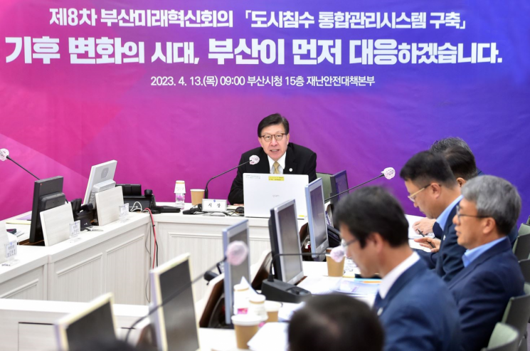
Attendees included Professor Lee Sang-ho of Pukyong National University, president of the Korean Water Resources Association; Professor Chu Tae-ho of Pusan National University, an expert in urban disaster prevention and hydrology; Kim Hyun-kyung, director of the Busan Regional Meteorological Administration; researchers from government research institutes; and representatives from companies. Experts from various fields such as water resources, urban flooding, disaster prevention, meteorology, and software (S/W) exchanged in-depth opinions on climate change and urban flooding response measures utilizing advanced technologies.
The meeting proceeded in the order of keynote presentations, policy announcements, system demonstrations, and opinion gathering and discussions. Professor Lee Sang-ho of Pukyong National University delivered the keynote speech on ‘Climate Change and Urban Flooding: Structural and Non-Structural Response Measures.’ Kim Kyung-deok, Director of the Citizen Safety Office of Busan City, presented policies regarding the ‘Urban Flooding Integrated Management System’ project for ‘Creating a Safe City Based on Smart Technology’ and its future tasks.
Busan City’s ‘Urban Flooding Integrated Management System’ is the first among local governments nationwide to provide real-time information related to urban flooding. Its core function is enabling users to respond to disasters by utilizing acquired flood risk information. This marks a paradigm shift from the previous provider-centered, passive dissemination of various risk information via smartphone messages and disaster texts to a user-based, active disaster response through real-time information provision.
The information provided through the system includes ▲user-based comprehensive urban flooding information ▲real-time meteorological observation data such as river water levels, tides, and rainfall ▲disaster information maps and natural disaster action guidelines.
The comprehensive urban flooding information is based on the ‘Urban Flooding Prediction Map’ and ‘Disaster Information Map’ for the entire Busan area, created through the ‘Urban Flooding Risk Area Analysis and Mitigation Measures Establishment’ project conducted from June 2019 to December 2020. It integrates and analyzes various real-time data collected from rainfall forecasts by the Korea Meteorological Administration, flood detection sensors, rain gauges, and river water level gauges to provide flood risk information in four stages: safe, caution, alert, and danger.
A particularly notable feature of the system is that in cases where evacuation is necessary, users can check road conditions, traffic control status, and shelter operation status all at once through the system, which also provides the optimal evacuation routes avoiding flooded areas.
The experts attending the meeting suggested various opinions for Busan to become the leading city in disaster response such as urban flooding, including ▲the need to collaborate with central agencies like the Ministry of Environment and the Korea Meteorological Administration to advance the system ▲consideration of integrating disaster information such as drought and heatwaves beyond urban flooding ▲tasks to improve the reliability of disaster prediction and real-time information.
The city announced that it will sufficiently supplement the experts’ opinions and its own improvement points raised at today’s meeting and start the service of the Urban Flooding Integrated Management System in the second half of this year.
However, it was noted that in the early stages of the service, the flood risk information generated may be somewhat inaccurate due to a lack of observation equipment such as flood detection sensors and collected data, as well as the fact that the developed algorithms have not been verified in actual situations.
Accordingly, the city plans to enhance data accumulation and quality through expanding observation equipment, system advancement, and data linkage expansion.
Mayor Park Hyung-jun emphasized that citizen safety is the top priority above all else, stating, “No one is safe until everyone is safe.”
He added, “The most important part of disaster response is how quickly we can detect and respond to disasters occurring in unexpected places or blind spots. To this end, we aim to go beyond merely providing disaster information and strive for an interactive system that communicates and exchanges information with citizens in real time during disaster situations.”
The ‘Busan Future Innovation Meeting’ is a regular monthly meeting involving the public, government, industry, and academia, led by Mayor Park Hyung-jun to proactively address pressing city issues and seek strategic implementation plans through broad discussions.
© The Asia Business Daily(www.asiae.co.kr). All rights reserved.
![Clutching a Stolen Dior Bag, Saying "I Hate Being Poor but Real"... The Grotesque Con of a "Human Knockoff" [Slate]](https://cwcontent.asiae.co.kr/asiaresize/183/2026021902243444107_1771435474.jpg)


