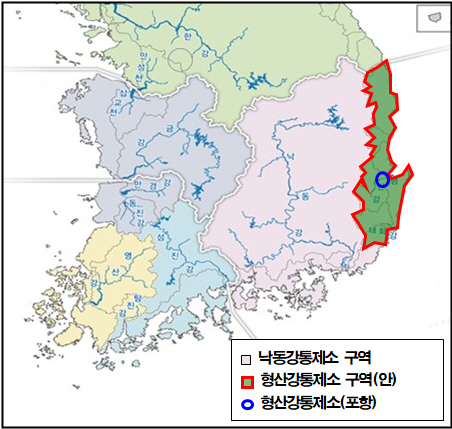
Establishment of Hyeongsan River Flood Control Office in East Coast Area and Proposal to Ministry of Environment
Installation and Pilot Operation of Multipurpose Observation Station... Accurate and Prompt Forecasting
Pohang City is accelerating the construction of a safe city by proposing the establishment of the Hyeongsan River Flood Control Center and expanding the national hydrological observation network to protect citizens' lives and property from abnormal weather caused by global warming and super typhoons like Hinnamnor.
Flood control centers have been operated since the Han River Flood Control Center was established in 1974, followed by the Nakdong River Flood Control Center, Geum River Flood Control Center, and Yeongsan River Flood Control Center, as the importance of flood control has become urgent to prevent flood damage caused by recurring heavy rains and typhoons every year.
East Coast rivers such as the Hyeongsan River fall under the jurisdiction of the Nakdong River Flood Control Center, but unlike rivers on the southern and western coasts, East Coast rivers are short in length, steep in gradient, and have a high flow variability coefficient, causing water levels to rise rapidly during floods.
In particular, flood concerns have increased for the Hyeongsan River, with flood forecasts issued annually since 2018. Large residential areas, national key industries, and world historical sites are adjacent to East Coast rivers such as the Hyeongsan River and Taehwa River, making an independent specialized flood control institution urgently needed to protect citizens' lives and property, industrial complexes, and cultural heritage.
Accordingly, Pohang City proposed the establishment of the Hyeongsan River Flood Control Center, which will oversee an area of 4,951 km² covering the East Coast region (Gyeongbuk Pohang City, Gyeongju City, Yeongdeok County, Uljin County, and Ulsan City), to the Ministry of Environment on February 22. The proposal was adopted as a recommendation by the Gyeongbuk Mayors and County Governors Council and is currently planned to be submitted to central government agencies and Gyeongbuk Province.
Along with this, the city completed the construction of a multi-purpose observation station, a national hydrological observation network, at Mundeok 3 Bridge in Mundeok-ri, Ocheon-eup in March this year to provide accurate and prompt flood forecasts for Naengcheon Stream, and it is currently in pilot operation.
The multi-purpose observation station installed at Naengcheon is a national facility installed and operated by the Nakdong River Flood Control Center. Once the station operates normally, continuous and precise measurements of water levels and flow velocity are expected to enable rapid and accurate flood forecasting.
The city plans to expand the national hydrological observation network in the long term to major local rivers such as Chilseongcheon, Gokgangcheon, and Gasacheon in cooperation with the Nakdong River Basin Environmental Office, and continues to propose the installation of rainfall radar in the Pohang area for accurate rainfall measurement.
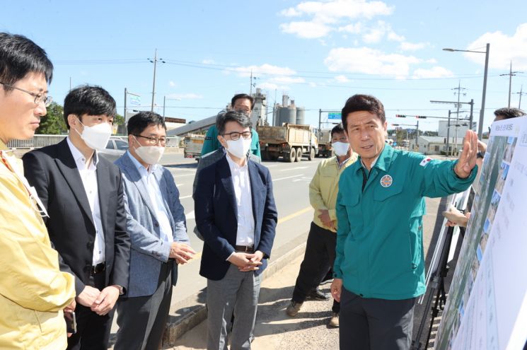 Mayor Lee Gang-deok of Pohang giving an on-site briefing while visiting the typhoon-affected area (Ocheon Naengcheon Indeokgyo) in September last year.
Mayor Lee Kang-deok said, “In an era where climate change is frequent and natural disasters are becoming stronger, rapid and accurate forecasting is essential for fundamental preparedness,” adding, “We will actively promote the establishment of the Hyeongsan River Flood Control Center and the expansion of the national hydrological observation network in cooperation with central government agencies to create a safe city Pohang where citizens and businesses can feel secure.”
© The Asia Business Daily(www.asiae.co.kr). All rights reserved.


