Busan Living Map Provides Location-Based Viewing Service for 16 Years
Unauthorized Building Property Rights Can Be Pre-Checked Before Verification
[Asia Economy Yeongnam Reporting Headquarters Reporter Dongguk Lee] Through Busan City's internet map service, ‘Busan Living Map,’ the geographical changes across the entire Busan area can be viewed at a glance with annual aerial photographs.
The city utilizes an analog aerial photograph database created from 1972 to 2008, undergoing processes such as image correction, compilation, color correction, and image fusion to produce orthophotos, which have been publicly available to citizens via web service since 2020.
An orthophoto refers to an image corrected for distortions caused by terrain relief, making it a map-like image with uniform scale.
Aerial photographs from over 30 years ago were difficult to identify for the same area due to significant changes in terrain and landmarks. However, through the orthophoto production process, coordinates were assigned to analog photos, enabling easy location searches by lot number or road name.
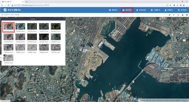
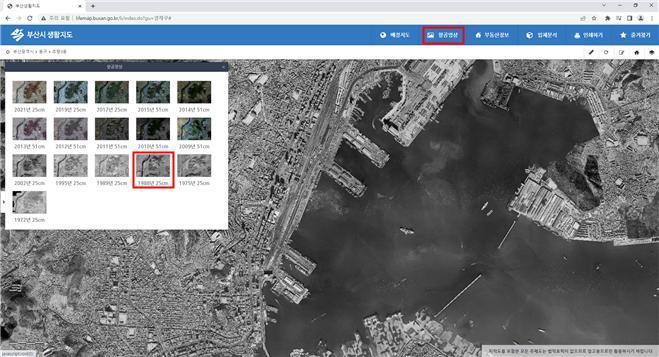
Currently, Busan Living Map includes aerial photographs from 16 different years between 1972 and 2021, allowing users to view the historical geographical changes of specific areas at a glance through searches by lot number or road name across the entire Busan area.
In particular, since February 8, the service has added aerial photographs from 1989, enabling users to check the existence of buildings before and after 1989 via the internet prior to applying for aerial survey interpretation for property rights enforcement of unauthorized buildings.
This additional service is expected to reduce administrative workload caused by unnecessary civil complaints and improve administrative reliability.
Lee Jeong-yong, Director of the Land Information Division of the city, stated, “Currently, aerial map services for 16 past years are provided, but we plan to continuously add analog aerial photographs from before 2008 and recent years that are not yet serviced. We will also strive to open more diverse spatial information by discovering location-based services closely related to citizens’ daily lives, not just aerial photographs.”
© The Asia Business Daily(www.asiae.co.kr). All rights reserved.


