Cold air moving south from the northwest brings continued cold through tomorrow
Inland temperatures below 5°C, below 0°C in northern Gyeonggi and inland/mountain areas of Gangwon
5-20mm rain in eastern Gyeongnam, around 5mm rain on the East Coast of Gyeongbuk
Dense fog in eastern Gyeonggi, western Gangwon, inland Chungcheong, and inland Gyeongbuk
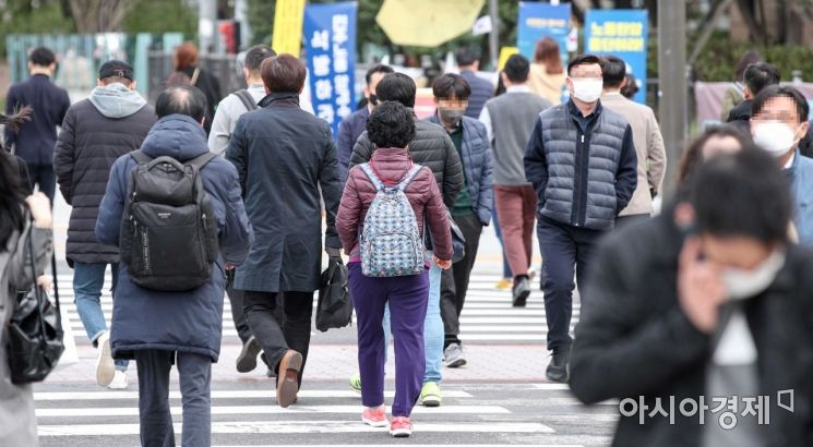 On the 18th, as the morning temperature in Seoul dropped to 4 degrees, an unexpected early winter weather continued. Office workers are seen wearing coats on their way to work at the Sejongno intersection in Jongno-gu, Seoul. Photo by Kang Jin-hyung aymsdream@
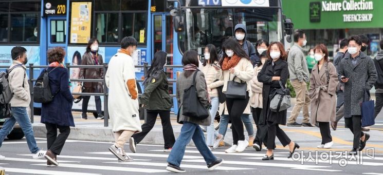
[Asia Economy Reporter Han Jinju] On Thursday the 21st, inland areas will experience cold weather with morning low temperatures dropping below 5 degrees Celsius. There is rain forecasted for the Gyeongsang region.
According to the Korea Meteorological Administration, as of 7 a.m., morning temperatures are recorded at 5°C in Seoul, 4.4°C in Suwon, 1.7°C in Chuncheon, 5.0°C in Cheongju, 4.4°C in Suwon, 4.2°C in Daejeon, 6.5°C in Daegu, 5.3°C in Jeonju, 6.8°C in Gwangju, and 12.2°C in Busan.
The day's highest temperatures will range from 14 to 20 degrees Celsius, with a temperature difference of about 15 degrees. Frost will form in the central inland, North Jeolla inland, North Gyeongsang inland, and northwest inland of South Gyeongsang. Ice may form in northern Gyeonggi, inland and mountainous areas of Gangwon, and northeastern mountainous areas of North Gyeongsang, so caution is advised for cold damage to crops.
On the 21st, the entire country will be occasionally cloudy, with the eastern Gyeongsang region mostly cloudy. Due to a pressure trough passing over the southern sea, eastern parts of South Gyeongsang will see rain from the morning, and the eastern coast of North Gyeongsang will have rain starting from noon. Rain will stop in the inland eastern part of South Gyeongsang from the afternoon, and raindrops may fall on the southern Gangwon east coast from night. During the rain in eastern South Gyeongsang, gusts and thunder/lightning are expected.
Expected rainfall amounts are 5 to 20 mm in eastern South Gyeongsang, Ulleungdo, and Dokdo, and around 5 mm on the eastern coast of North Gyeongsang. On the 22nd, due to easterly winds, rain may occur along the eastern coasts of North Gyeongsang and South Gyeongsang.
 On the 18th, as the morning temperature in Seoul dropped to 4 degrees, an unexpected early winter weather continued. Office workers are seen wearing coats on their way to work at the Sejongno intersection in Jongno-gu, Seoul. Photo by Kang Jin-hyung aymsdream@
Be cautious of dense fog during the morning commute. Until 9 a.m., dense fog with visibility less than 200 meters is expected mainly in eastern Gyeonggi, western Gangwon, inland Chungcheong, eastern North Jeolla, and inland North Gyeongsang.
As of 7 a.m., visibility at major locations is 100 meters in Yeoju, 110 meters in Icheon, 130 meters in Goesan, 130 meters in Sejong Goun, 130 meters in Sangdang (Cheongju), 140 meters in Jinan, 150 meters in Chungju, and 150 meters in Wanju. Currently, a low visibility warning is in effect at Cheongju Airport, and some airports may experience disruptions in flight operations, so it is necessary to check flight advisories in advance.
The Korea Meteorological Administration stated, "On bridges and roads near rivers, lakes, and valleys, fog may be denser than surrounding areas. When driving, maintain sufficient distance between vehicles and reduce speed to prevent collision accidents and other damages. Special caution is required."
A wind and wave advisory is in effect for the southern East Sea offshore area until the morning of the 21st, and for the central East Sea offshore area until the afternoon. Winds will blow very strongly at 10 to 16 meters per second, and waves will be very high at 2 to 4 meters. Due to incoming swell until the 22nd, high waves will strongly hit sandy beaches and may overflow rocky shores or breakwaters along the East Coast, so safety accidents should be carefully avoided.
© The Asia Business Daily(www.asiae.co.kr). All rights reserved.


