[Naju=Asia Economy Honam Reporting Headquarters Reporter Kim Yuk-bong] Naju City, Jeollanam-do (Mayor Kang In-gyu) announced on the 23rd that it will officially proceed with the ‘Small-scale Cadastral Resurvey Project’ for 40 parcels in the Dasi and Bonghwang areas.
The cadastral resurvey is a mid- to long-term national policy project aimed at protecting citizens' property rights and efficiently managing national land by correcting the boundaries in the cadastral register that do not match the actual status of the land to the real boundaries.
This project involves converting paper cadastral maps, which are over 100 years old and were created during the Japanese colonial period, into 3D digital cadastral maps to resolve cadastral discrepancies. It is being implemented step-by-step by 2030 under the ‘Special Act on Cadastral Resurvey’.
The current resurvey target areas are the ‘Dasi Donggok District’ (12 parcels) and the ‘Bonghwang Jukseok District’ (28 parcels).
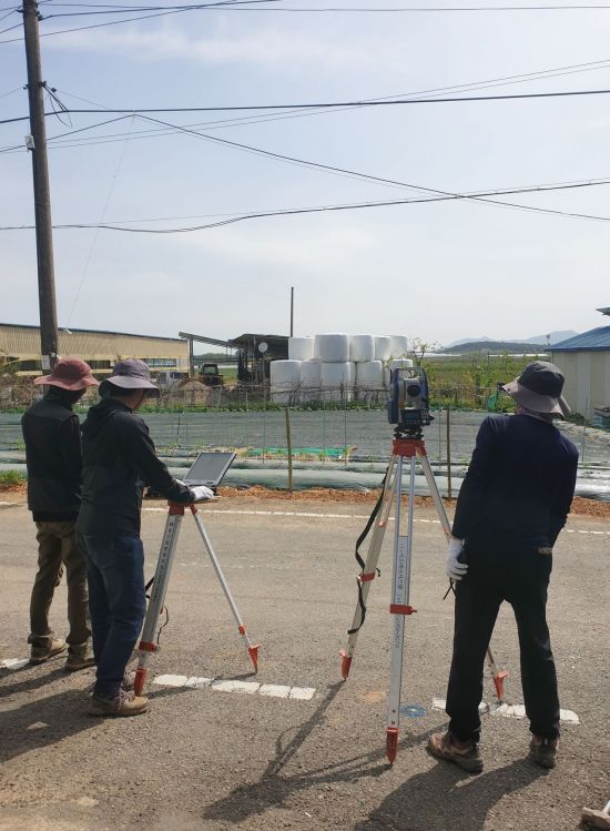
The city has completed public inspection of the implementation plan, collection of consent forms, drone video shooting, and residents’ briefing sessions, and on the 10th, designated and announced the districts through deliberation and resolution by the Jeollanam-do Cadastral Resurvey Committee.
Unlike large-scale districts where the project took an average of about two years to complete, the small-scale project districts are expected to be completed in the shortest possible time by encouraging all landowners to apply and actively participate.
The current surveying and investigation will be conducted by Korea Surveying Corporation, and administrative procedures such as explanation sessions on survey results, objection submissions, and boundary decisions are planned with the goal of organizing new cadastral registers early next year.
Kim Mi-ryeong, Director of the Citizen Service Division, said, “This project provides cadastral administrative services such as land boundary confirmation without the burden of surveying costs, resolves boundary disputes, and protects citizens’ land property rights. We ask for the active participation and cooperation of landowners.”
© The Asia Business Daily(www.asiae.co.kr). All rights reserved.


