Map Service to Easily View and Support 'Good Stores' Offering Free Meals for Food-Insecure Children
Maps of 62 Seoul Landmarks' Walkways for Mobility-Impaired, and Screening Clinics in English, Chinese, and Japanese
[Asia Economy Reporter Lim Cheol-young] The Seoul Metropolitan Government announced that it will improve the ‘Smart Seoul Map’ by incorporating the locations and information of ‘Good Stores’ practicing neighborly sharing into the map for easy viewing at a glance, and will unveil it on the 25th. Accordingly, the information provided will be expanded from the existing 93 types to 96 types.
The ‘Smart Seoul Map’ (Urban Life Map) is a digital map that visualizes administrative information, which was previously in document form like Excel, by displaying it on a map for easy viewing at a glance. It can be accessed directly on PCs and smartphones without installing any additional programs. Currently, it offers 93 themed maps including child protection zones, vegetarian restaurants, and unmanned civil service kiosks, and shares information with private map services such as Naver Map and Kakao Map.
In particular, Seoul City will newly provide three types of maps with the purpose of encouraging citizens’ ethical consumption to help small business owners struggling due to COVID-19, improving foreign nationals’ access to information to prevent the spread of COVID-19, and enhancing convenience for mobility-impaired pedestrians.
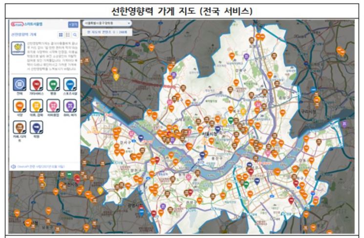
The map supporting ethical consumption provides information on ‘Stores with Good Influence’ and ‘We Save Stores.’ The 726 ‘Stores with Good Influence’ are voluntary citizen groups of stores that offer free meals to vulnerable children using meal cards. The 533 ‘We Save Stores’ participate in Save the Children’s donation campaign by donating a portion of their monthly profits.
The ‘Mobility-Impaired Pedestrian Walk’ map categorizes various routes from nearby subway stations to destinations into ?Excellent (Recommended), ?Average (Accompanied by Guardian Possible), and ?Poor (Not Recommended) for detailed display. This helps mobility-impaired pedestrians, who usually face difficulties in outdoor activities due to lack of information, to choose walking locations. The COVID-19 Screening Clinic Foreign Language Map is created in three languages?English, Chinese, and Japanese?to help foreigners easily find screening clinics and temporary screening sites for testing, and is provided through Seoul City’s foreign language website.
Seoul City is preparing various urban life maps such as the free public Wi-Fi ‘Kkachion’ location map and kiosk location maps to bridge the digital divide. Going forward, the city aims to continuously discover and update maps with life information that citizens need or should know to improve the quality of life for its residents.
Additionally, Seoul City will introduce a new map visualization service from the 25th to enhance the readability and usability of map information. In addition to the existing point, line, and area displays, various functions will be added to more effectively show facility density and the range of service benefits.
Lee Won-mok, Director of Seoul City’s Smart City Policy Division, said, “In the COVID-19 era when outdoor activities are difficult, we are creating a new model of citizen communication by providing local life-centered living and administrative information through the Smart Seoul Map,” and added, “Citizens will also utilize map visualization well to propose detailed community-based policies, thereby laying the foundation for a smart city Seoul.”
© The Asia Business Daily(www.asiae.co.kr). All rights reserved.


