[Asia Economy Reporter Joo Sang-don] The National Oceanographic Research Institute of the Ministry of Oceans and Fisheries announced on the 13th that it has produced and distributed an English promotional material of the ocean current schematic map including Korean marine place names such as the East Sea and Dokdo.
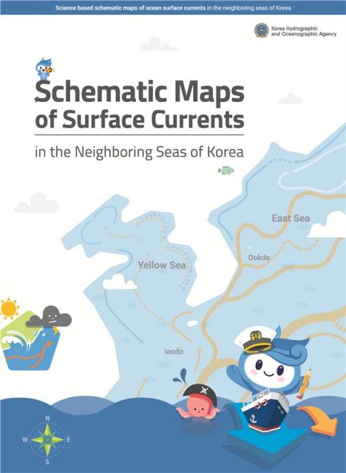
The ocean current schematic map is a simplified and easy-to-understand map representing the complex flow of seawater. It allows viewers to see at a glance where the East Sea water flows from. The East Sea water flows in through the Korea Strait and mostly exits to the Pacific Ocean through Japanese straits (Tsugaru and Soya).
To accurately understand and inform about the ocean current information of the East Sea and surrounding waters, the Oceanographic Research Institute collaborated with academia and research institutions from 2011 to 2016 to produce the ocean current schematic map over six years. Since 2018, it has been utilized in educational settings by being included in middle and high school textbooks. In particular, in 2019, the method and process of producing the ocean current schematic map were included in an international professional book, presenting international standards for the production of such maps.
This year, through consultation with oceanographers, an English promotional material of the ocean current schematic map was produced to actively promote Korea’s maritime territory overseas. The English promotional material introduces detailed ocean current schematic maps along with the names and characteristics of major currents around the Korean Peninsula such as the East Korea Warm Current, North Korea Cold Current, Tsushima Warm Current, and Primorsky Cold Current, and includes explanations about the impact of ocean currents on weather and climate as well as the application fields of the schematic map.
The English promotional material of the ocean current schematic map will be distributed not only to major universities and research institutions but also to private organizations promoting Korea’s maritime territory such as VANK, a cyber diplomatic mission established in 1999, and the Dokdo Research Institute. It is planned to be used as educational material in lectures and as promotional material at international conferences and events.
Hong Rae-hyung, Director of the Oceanographic Research Institute, said, "The English promotional material of the ocean current schematic map is significant in that it naturally informs the international community of Korea’s marine place names such as the East Sea and Dokdo along with its educational effect." He added, "We hope that the schematic map will become better known to more people through both Korean and English versions and be actively utilized in various fields."
© The Asia Business Daily(www.asiae.co.kr). All rights reserved.
![Clutching a Stolen Dior Bag, Saying "I Hate Being Poor but Real"... The Grotesque Con of a "Human Knockoff" [Slate]](https://cwcontent.asiae.co.kr/asiaresize/183/2026021902243444107_1771435474.jpg)


