Uncertain Typhoon Paths
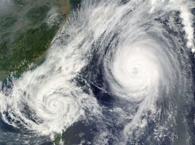
Another round of rain is forecast nationwide over the weekend, while Typhoon Mitag, the 17th typhoon of the season, and Typhoon Ragasa, the 18th, are both expected to form in succession in the northwestern Pacific. With the possibility of Typhoon Noguri, the 19th typhoon, also developing, there is growing attention on the paths of autumn typhoons.
According to the Korea Meteorological Administration on September 18, Tropical Depression No. 37 was moving at a speed of 54 km/h (15 m/s) over waters about 500 km north-northwest of Manila, Philippines, as of 3 a.m. that day. This depression is expected to be upgraded to Typhoon Mitag, the 17th typhoon of the season, over waters southeast of Hong Kong at 3 a.m. on September 19. After making landfall north of Hong Kong on September 20, it is expected to weaken and dissipate into a tropical depression by September 21. Mitag is a female name submitted by the Federated States of Micronesia.
Tropical Depression No. 38 is also expected to develop into Typhoon Ragasa, the 18th typhoon, over waters northeast of Manila, Philippines, at 3 a.m. on September 19. Its central pressure is predicted to be 998 hPa, with maximum wind speeds of 19 m/s (68 km/h). Ragasa means "rapid movement" in Filipino. It is expected to move westward along the waters east of the Philippines until September 23, but its path after that remains uncertain.
The Korea Meteorological Administration also announced that, in addition to these typhoons, additional tropical disturbances (the seeds of typhoons) have been detected over the waters near Okinawa, Japan. As a result, there is a possibility that autumn typhoons such as Typhoon Noguri, the 19th, and Typhoon Bualoi, the 20th, may form in succession.
However, the strength and paths of these typhoons remain uncertain, making it difficult to predict whether they will have a direct impact on the Korean Peninsula.
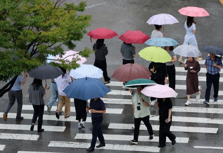
Rain is expected to fall nationwide from the afternoon of September 19 through the morning of September 20. Lee Changjae, a forecast analyst at the Korea Meteorological Administration, stated during a regular briefing that "due to the influence of a low-pressure system approaching from the west, rain will fall across the country on the night of September 19," adding, "Most regions will see the rain stop by the morning of September 20, but on the east coast of Gangwon, due to easterly winds, rain may continue in some areas until the morning of September 21."
In particular, from the early morning to the morning of September 20, heavy rain of around 30 mm per hour is expected, especially along the southern west coast of Chungnam and the west coast of Jeonbuk. Nationwide, cumulative rainfall is forecast to range from 10 to 60 mm. The Yeongdong region of Gangwon, which has recently experienced drought, is expected to receive an additional 10 to 40 mm of much-needed rain, which should help restore reservoir levels.
The Korea Meteorological Administration stated, "With sea surface temperatures remaining high, tropical disturbances that serve as the seeds of typhoons are actively forming," and added, "Depending on how these systems develop and the paths they take, weather volatility in the medium term could increase significantly."
© The Asia Business Daily(www.asiae.co.kr). All rights reserved.


