Incheon City is creating a high-precision electronic map that is updated annually.
The city announced on the 4th that it was selected for the Ministry of Land, Infrastructure and Transport's 'High-Precision Electronic Map Construction Challenge Project' and secured 1.15 billion KRW in national funding. Following last year, the city was selected for the second consecutive year and will receive a total of 2.4 billion KRW in national funding over two years.
This project aims to build electronic maps (1:1000 digital topographic maps) and digital twins for data-driven administrative tasks and private sector use. Using new technologies such as Lidar (a device that emits laser beams and measures the distance and surrounding features by the time it takes for the beams to reflect back) and drones, detailed electronic maps of changed terrain and features such as roads and buildings will be created.
High-precision electronic maps are used as basic data for administrative tasks in both public and private sectors, including policy making, planning, permits, urban planning and management, and facility statistics. However, compared to the rapid changes in the Incheon area, updates to terrain and feature information have not been made in a timely manner.
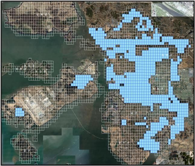 Incheon City is promoting the renewal of electronic maps that have been in use for 5 to 25 years, covering a total area of 105.75㎢ (blue areas). Photo by Incheon City
To improve this, the city has been participating in the High-Precision Electronic Map Construction Challenge Project since last year, aiming to establish an annual update system. It is conducting electronic map revision and construction for 135.75㎢ of outdated and unupdated areas and researching optimization plans for the Incheon-type electronic map annual update system.
This year, the city plans to update a total of 105.75㎢ of electronic maps that were created 5 to 25 years ago, and to conduct a pilot project for the Incheon-type high-precision electronic map update system applying advanced technologies such as spatial and administrative information utilization and AI-based terrain information change detection.
The Incheon-type annual electronic map update system will be the first among metropolitan cities and provinces nationwide, with a pilot introduction planned for next year. The city expects this to enhance citizen safety and convenience, advance data linkage and utilization in the public sector, and improve the efficiency of policy decisions. It will also reduce annual revision and production costs by about 5 billion KRW.
An official from Incheon City stated, "We will ensure that citizens can use the latest electronic maps more conveniently," and added, "We will strive to build high-quality, high-precision spatial information to contribute to the growth of related industries and technological development."
© The Asia Business Daily(www.asiae.co.kr). All rights reserved.


