The Korea Forest Service aims to promote the digital transformation of forest policies, focusing on the launch and utilization of agricultural and forestry satellites. The purpose of this digital transformation is to strengthen disaster prevention through precise forest data derivation and to enhance the convenience of forest welfare for the public.
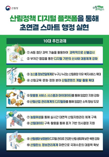
On the 13th, the Korea Forest Service announced the "Top 10 Initiatives for Digital Transformation of Forest Policies" reflecting these goals.
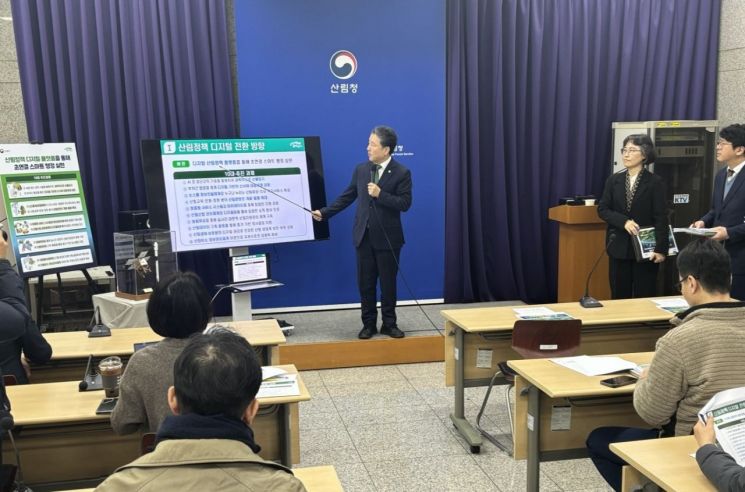 Nam Seong-hyeon, the Commissioner of the Korea Forest Service, is announcing the "Top 10 Digital Transformation Tasks for Forest Policy" on the 13th at the Government Daejeon Complex. Provided by Korea Forest Service
The core infrastructure of the digital transformation is the agricultural and forestry satellite. The Korea Forest Service plans to complete a real-time, large-area forest management system in line with the 2025 agricultural and forestry satellite launch schedule. In July this year, the "National Forest Satellite Information Utilization Center" will also be established.
The agricultural and forestry satellite development project involves the Ministry of Science and ICT, the Korea Forest Service, and the Rural Development Administration. Korea Aerospace Industries (KAI) is in charge of overall satellite development, while the Korea Aerospace Research Institute (KARI) is responsible for the payload.
Once the agricultural and forestry satellite is utilized, the current Korean Peninsula imaging cycle, which was 10 days last year (using foreign satellites), is expected to improve to 1 day, and the resolution will be refined from observing within a 10m range to a 5m range.
The Korea Forest Service expects to integrate artificial intelligence technology with satellite data collected by the agricultural and forestry satellite to predict the flowering periods of trees and plants and automatically calculate the area affected by forest disasters. Additionally, they plan to develop 36 algorithms combining satellite data and AI technology and incorporate the results derived from these algorithms into forest policies.
In particular, by expanding the scope of agricultural and forestry satellite utilization, they emphasized strengthening international cooperation in the forestry sector by providing satellite information data to countries observable by satellite, such as Vietnam, Brunei, Cambodia, Uruguay, and New Zealand.
The Korea Forest Service will also expand the use of digital forest maps that can represent the nationwide forest status as data. They plan to increase the types of forest maps collected and utilized from the current 18, including forest stand maps and forest soil maps, to 32 by adding forest water maps and ecological maps.
Furthermore, they will build a "Forest Spatial Digital Platform" capable of collecting, analyzing, and utilizing large-scale spatial information such as forest maps, forest satellite information, and forest digital twins, and plan to fully open most of the accumulated forest public data (excluding security-related information such as personal data) to the private sector by 2025.
The digital transformation of forest policies by the Korea Forest Service will also focus on strengthening the response capabilities for forest fires and landslides. First, the Korea Forest Service will expand an AI-based information technology (ICT) platform that can automatically monitor and interpret forest fire occurrences in real time 24/7 to minimize blind spots in forest fire surveillance.
To minimize landslide damage, the current "Landslide Information System," which mainly covers mountainous areas, will be expanded and reorganized into a "Pan-Ministerial Digital Slope Integrated Landslide Information System" that integrates and manages slope information handled by other ministries. By reforming the prediction system, it will be possible to secure the golden time for resident evacuation.
Additionally, the Korea Forest Service plans to expand digital services by allowing reservation services for natural recreation forests, forest education, and healing facilities, which were previously available only on the Korea Forest Service website, to be accessible through private apps such as Naver and Kookmin Bank. They also aim to strengthen income and support for forestry workers through the digitalization of forest industry management.
Nam Sung-hyun, Administrator of the Korea Forest Service, stated, "Forests cover 63% of our country's land. The Korea Forest Service will strive to enable 2.2 million forest owners, 210,000 forestry workers, and ultimately all citizens to enjoy forest benefits more easily and conveniently through scientific management and efficient utilization of forests."
© The Asia Business Daily(www.asiae.co.kr). All rights reserved.


