Heavy Snow of 5~10cm in Chungnam and Jeonbuk, West Coast to Jeju
Cold Peaks the Day After Tomorrow... Nationwide Strong Winds Forecasted
Starting from the afternoon of the 20th, a cold northwesterly wind will blow again, causing temperatures to plummet and bringing the strongest cold wave of this winter.
The morning low temperature on the 20th is expected to range between -12°C and 1°C, slightly lower than the average temperature. From midday, under the influence of a continental high pressure system expanding from northern China, cold air will flow in from the north, causing temperatures to drop sharply. The daytime high on the 20th will range between -7°C and 4°C.
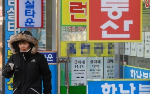
![[Tomorrow's Weather] Temperature Drops Sharply from Noon Due to North Wind... Heavy Snow Forecast on the West Coast](https://cphoto.asiae.co.kr/listimglink/1/2023121908372592818_1702942645.jpg) On the 19th, as the morning temperature in Seoul dropped to minus 7.4 degrees Celsius, the cold wave continued. Office workers are seen wearing thick coats while commuting to work on Sejong-daero, Jung-gu, Seoul. Photo by Jinhyung Kang aymsdream@
On the 19th, as the morning temperature in Seoul dropped to minus 7.4 degrees Celsius, the cold wave continued. Office workers are seen wearing thick coats while commuting to work on Sejong-daero, Jung-gu, Seoul. Photo by Jinhyung Kang aymsdream@
The expected minimum and maximum temperatures in major cities are as follows: Seoul -9°C to -5°C, Incheon -8°C to -6°C, Daejeon -6°C to -2°C, Gwangju -2°C to -1°C, Daegu -3°C to 0°C, Ulsan -1°C to 1°C, and Busan 1°C to 3°C.
On the 21st, temperatures will drop further, potentially bringing the 'strongest cold wave.' The morning low on the 21st is expected to be between -20°C and -5°C, with daytime highs ranging from -10°C to 2°C. Temperatures on the 22nd are expected to be similar to those on the 21st.
According to forecasts, the 21st and 22nd will likely mark the 'peak' of this cold spell. Strong winds will also blow, intensifying the cold. From the night of the 19th, most areas are expected to experience gusts exceeding 55 km/h (15 m/s). Especially from the 20th, strong winds with gusts exceeding 70 km/h (up to 90 km/h in mountainous areas) will blow along the Chungnam west coast, Jeolla west coast, Gyeongsang east coast, and Jeju. At sea, from the night of the 19th, the central West Sea offshore will experience winds of 35-65 km/h and waves of 2-4 meters (with waves exceeding 5 meters in the East Sea offshore), except for the southern sea nearshore.
The strong winds will not only increase the cold but also raise the risk of fires. Dry weather warnings have been issued for Gangwon Yeongdong and eastern Gyeongsang, and the air east of the Baekdudaegan mountain range will gradually become drier, so caution is needed to prevent fires.
Heavy snowfall is expected mainly in areas bordering the West Sea such as southwestern Gyeonggi, Chungnam, western Jeolla, and Jeju. Snow fell and accumulated on the 19th in the metropolitan area, inland and mountainous areas of Gangwon, and northern Chungcheong. Snow is still falling and accumulating. In the metropolitan area alone, as of 4 p.m., scattered light snow or snow flurries are occurring in various places. Snow is expected to continue until late at night in Seoul and northern Gyeonggi, and until early morning on the 20th in Incheon and southern Gyeonggi.
![[Tomorrow's Weather] Temperature Drops Sharply from Noon Due to North Wind... Heavy Snow Forecast on the West Coast](https://cphoto.asiae.co.kr/listimglink/1/2023121908373092819_1702942650.jpg) On the 19th, as the morning temperature in Seoul dropped to minus 7.4 degrees Celsius, the cold wave continued. Office workers are seen wearing thick coats and heading to work on Sejong-daero, Jung-gu, Seoul. Photo by Jinhyung Kang aymsdream@
On the 19th, as the morning temperature in Seoul dropped to minus 7.4 degrees Celsius, the cold wave continued. Office workers are seen wearing thick coats and heading to work on Sejong-daero, Jung-gu, Seoul. Photo by Jinhyung Kang aymsdream@
On the night of the 19th, snow or rain is also expected along the southern Chungnam west coast and northern Jeonbuk west coast. On the 20th, snow will fall mainly in Chungcheong, Honam, and Jeju. Heavy snowfall is expected in southwestern Gyeonggi from late night on the 20th to early morning on the 21st. By region, most areas in Chungnam will experience snow from the 20th to the 21st, with particularly heavy snowfall expected along the Chungnam west coast and northern inland areas. In Chungbuk, snow is expected mainly in the central and southern parts from the night of the 20th to early morning on the 21st.
In Jeonbuk, heavy snow is expected mainly in the western region from the night of the 19th to the 21st, with snowfall continuing until the 22nd in western Jeonbuk. In Jeonnam, snow is expected to begin falling in the early morning of the 20th, with heavy snowfall concentrated in Gwangju and western Jeonnam. Like western Jeonbuk, these two areas may see snow continuing until the 22nd. In Jeju, snow is expected from the early morning of the 20th in the mid-mountain and mountainous areas, with snow or rain along the coast, and heavy snowfall is expected to continue until the 22nd.
The snow falling this time is wetter than average and will accumulate well. Snowfall amounts from the 19th to the 20th are expected to be 5-10 cm along the Chungnam west coast, Jeonbuk, Ulleungdo, and Dokdo (with up to 15 cm in Jeonbuk), 2-7 cm in southwestern Gyeonggi, Sejong, inland Chungnam (excluding southeastern inland), Gwangju, northern Jeonnam, mid-mountain and mountainous areas of Jeju (with up to 10 cm in Jeju mountains), 1-5 cm in Incheon, the five West Sea islands, Chungbuk, and southern Jeonnam, and 1-3 cm in southeastern Gyeonggi, Seoul, and northern Gyeonggi.
Other areas expecting snowfall will see about 1 cm or less than 1 cm.
The Korea Meteorological Administration urged, "With prolonged snowfall mainly along the Chungnam west coast and western Jeolla, the weight of the snow may cause collapse of livestock barns or vinyl greenhouses, and accumulated and frozen snow may create icy roads, so please be especially careful."
© The Asia Business Daily(www.asiae.co.kr). All rights reserved.


