Busan Gijang-gun is creating village cadastral maps that integrate drone footage and various spatial information to promote public projects and enhance the convenience of residents.
The production of village cadastral maps was initiated due to the need for spatial information using drones in various public sector projects. The production was carried out by 'Ultra-light Flying Device Operator Certificate' holders affiliated with Gijang-gun, who directly captured ultra-precise orthophotos in connection with the training of drone pilots.
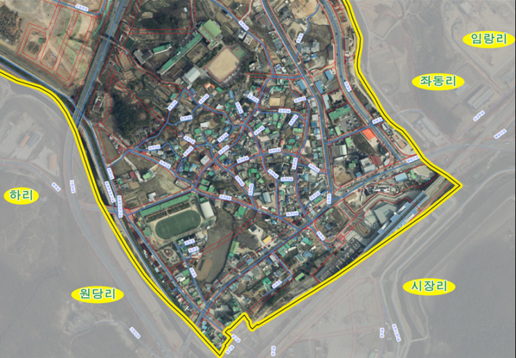
In October, the county completed drone video shooting targeting districts where cadastral re-survey projects were completed and villages by eup and myeon, and plans to distribute the village cadastral maps in November after the production process.
The village cadastral maps will display accurate spatial information such as road sections and urban management planning lines, serving as basic data for efficient village joint planning.
Jeong Jong-bok, the head of Gijang-gun, said, “We expect that the production of these village cadastral maps will greatly help not only in promoting various public projects but also in improving the convenience of residents' lives,” adding, “We will strive to enhance the professionalism of our staff in drone operation and to continuously manage the village cadastral maps.”
© The Asia Business Daily(www.asiae.co.kr). All rights reserved.


