Weekend Nationwide Rain Forecast, Over 100mm in Many Areas
Typhoon Doksuri's Path Also a Variable... "Prolonged Monsoon Front"
As heavy rain is expected nationwide again over the weekend, Typhoon No. 5 'Doksuri' formed on the 21st, prompting the Korea Meteorological Administration (KMA) to closely monitor its path and impact. Since the typhoon is in its early development stage, it is too soon to predict its trajectory, but it may indirectly affect the formation of rain clouds over the Korean Peninsula. The monsoon rain expected this weekend was also influenced by Typhoon No. 4 Talim.
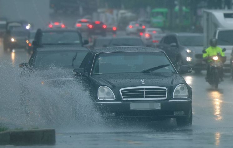
On this day, the KMA forecasted rain across the country from the weekend, the 22nd to the 24th. A stationary front and low pressure system formed over inland China are approaching, bringing rainfall that could exceed 100mm in some areas.
By region, the Seoul metropolitan area and the five western islands are expected to receive 50 to 100mm of rain, with northern Gyeonggi Province possibly seeing over 150mm. Daejeon, Sejong, and Chungnam, which previously suffered heavy rain damage, are forecasted to receive 30 to 80mm (with northern Chungnam and the southern Chungnam west coast possibly exceeding 120mm), central and northern Chungbuk 20 to 60mm, and southern Chungbuk 10 to 40mm.
In Honam, the western parts of Gwangju, Jeonnam, and Jeonbuk are expected to receive 30 to 80mm (with the Jeonnam coast and Jeonbuk west coast possibly exceeding 120mm and 100mm respectively), and eastern Jeonbuk 20 to 60mm of rain.
In the Gyeongsang region, the western southern coast of Gyeongnam and areas near Jirisan are expected to receive 30 to 80mm (with some areas exceeding 100mm), Busan, Ulsan, central southern coast of Gyeongnam, inland Gyeongnam, and northern Gyeongbuk 20 to 60mm, and Daegu, southern Gyeongbuk, Ulleungdo, and Dokdo 10 to 40mm.
Jeju is forecasted to receive 30 to 80mm of rain, with the southern and mountainous areas possibly exceeding 150mm.
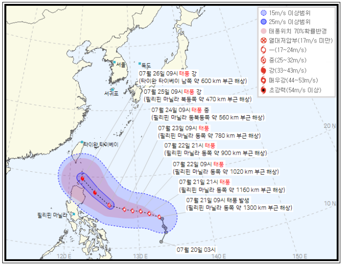 Typhoon Doksuri Expected Path for No. 5. [Image Source=Korea Meteorological Administration Typhoon Bulletin]
In this situation, Typhoon No. 5 Doksuri has formed. According to the KMA on this day, a tropical depression formed near the Philippines on the 20th developed into a typhoon by 9 a.m. on the 21st. Since it is in the early stage of development, it is too early to predict its path and impact, but it may affect the monsoon front after the 26th of next week.
The monsoon rain this weekend is also related to Typhoon No. 4 Talim, which dissipated on the 19th. Talim, which developed near Manila, Philippines on the 15th, caused heavy rainfall in southern China and Vietnam but had no direct impact on South Korea. However, it brought a large amount of hot and humid moisture to the Korean Peninsula, aiding the development of rain clouds.
Similarly, Doksuri may activate the monsoon front. The position of the monsoon front after the 26th is expected to be influenced by the edge of the North Pacific High, which is affected by Doksuri. Currently, Doksuri is forecasted to move toward inland China, but if it develops stronger than expected and moves further north, it could push the edge of the North Pacific High further than anticipated.
Kim Dae-jun, a forecaster at the KMA National Typhoon Center, explained, "Due to Talim, moisture was brought into South Korea along the edge of the North Pacific High, indirectly contributing to the development of rain clouds. Similarly, if Doksuri brings a large amount of moisture to the Korean Peninsula, the monsoon front could become more active."
© The Asia Business Daily(www.asiae.co.kr). All rights reserved.


