The National Geographic Information Institute of the Ministry of Land, Infrastructure and Transport announced on the 29th that it will hold a National Basic Map Vision Proclamation Ceremony to contribute to improving the quality of life for the people.
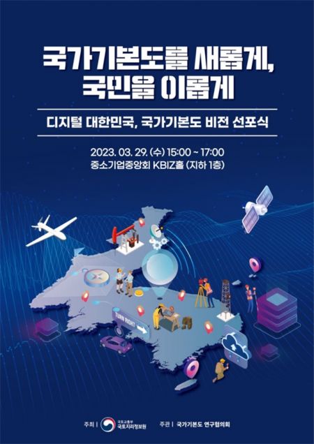
The proclamation ceremony, held in the afternoon, was promoted to present the direction for the advancement of the National Basic Map. Under the theme of Digital Korea, it aims to enable faster, more accurate, and more convenient use as core data for digital twins.
The keynote speech will be delivered by Professor Choi Jae-bung of Sungkyunkwan University. He will address the role of maps and the future vision of the National Basic Map amid technological and industrial developments such as digital twins. Following this, four user organizations?Ministry of the Interior and Safety (address sector), Korea Forest Service (forest sector), Daewoo Construction (smart construction sector), and SKT (robotics sector)?will present topics on the direction the national map should take in response to environmental changes. Finally, the National Geographic Information Institute will present the advanced form and promotion strategy of the National Basic Map that can meet the demands of map users and lead the era.
Since last year, the National Geographic Information Institute has been conducting research to advance the National Basic Map, reviewing improvements with industry and experts. This stems from the demand that the map’s timeliness and accuracy must be enhanced and compatibility improved for the development of digital twin technology. A blueprint for changes to the National Basic Map was needed to move toward a Digital Korea where all real-world data is connected to maps, enabling autonomous driving and free movement of wheelchairs and robots.
The National Geographic Information Institute plans to finalize the advancement plan for the National Basic Map by synthesizing opinions from stakeholders at this vision proclamation ceremony. In the future, the National Basic Map is expected to be enhanced in timeliness by utilizing various public and private data and to be linked and utilized across multiple sectors.
Jo Woo-seok, Director of the National Geographic Information Institute, said, "While the National Basic Map has so far secured reliability focusing on accuracy, it will now evolve into a digital live map befitting Digital Korea," adding, "We will build consensus and a cooperative system with various experts and stakeholders."
Meanwhile, at the proclamation ceremony, a business agreement will also be signed with 34 local governments targeted for the production of digital topographic maps to build a 1:1000 high-precision electronic map, which is part of the national agenda.
© The Asia Business Daily(www.asiae.co.kr). All rights reserved.
![Clutching a Stolen Dior Bag, Saying "I Hate Being Poor but Real"... The Grotesque Con of a "Human Knockoff" [Slate]](https://cwcontent.asiae.co.kr/asiaresize/183/2026021902243444107_1771435474.jpg)


