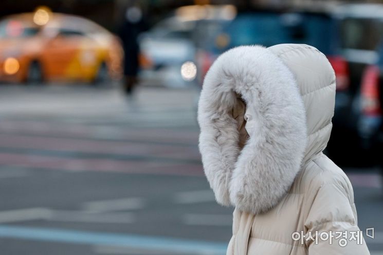
 On the 25th, when a cold wave advisory was issued nationwide with the morning low temperature in Seoul dropping to minus 18 degrees Celsius, office workers wearing thick coats are heading to work at the Sejongno intersection in Jongno-gu, Seoul. Photo by Kang Jin-hyung aymsdream@
[Asia Economy Reporter Seongpil Cho] The cold wave will continue through the last weekend of January.
According to the Korea Meteorological Administration on the 27th, cold air continues to descend from the north, and the morning low temperature on Saturday the 28th will be between -18°C and -4°C, 2 to 6 degrees lower than this morning. In particular, the central inland and Gyeongbuk inland areas will see morning temperatures drop to around -15°C.
The daytime high on the 28th is expected to range from -5°C to 3°C. The central region and southern inland areas will remain below freezing even during the day. The expected low and high temperatures for major cities are Seoul -12°C and -2°C, Incheon -10°C and -2°C, Daejeon -11°C and -1°C, Gwangju -7°C and 1°C, Daegu -9°C and 1°C, Ulsan -8°C and 1°C, and Busan -7°C and 3°C.
On Sunday the 29th, temperatures will rise slightly but the severe cold will persist. Morning lows on the 29th will range from -16°C to -1°C, and daytime highs are expected to be between 1°C and 7°C. Strong winds will blow throughout the weekend, intensifying the cold. The west coasts of Chungnam, Jeolla, parts of the Gyeongnam coast, and Jeju will experience gusts reaching 70 km/h (90 km/h in mountainous areas) on the 27th and 28th, with other regions also facing strong winds exceeding 55 km/h.
Snowfall will continue until this evening on the Jeolla west coast, centered around Jeolla west coast, Jeju, and Ulleungdo. According to the forecast released at 5 p.m. by the Korea Meteorological Administration, additional snowfall amounts are expected to be 10-30 cm for Ulleungdo and Dokdo, 5-10 cm (with some areas exceeding 15 cm) for Jeju mid-mountain and Jeju mountainous areas, 1-5 cm for Jeju coast, and 1-3 cm for Jeolla west coast.
Snow will resume on the morning of the 28th from the Chungnam west coast and Jeolla west coast. By afternoon, snow will fall in southern Gyeonggi, Chungnam, central Chungbuk, southern Chungbuk, and Honam, with flurries in Seoul, Incheon, northern Gyeonggi, Gangwon Yeongseo, western inland Gyeongbuk, and northwestern inland Gyeongnam. Expected snowfall amounts are 1-3 cm for Chungnam, Honam (excluding eastern coastal Jeonnam), and the five western islands, and less than 1 cm for southern Gyeonggi, central and southern Chungbuk, and southeastern coastal Jeonnam.
On the 29th at night, snow will fall in various parts of inland Gangwon and Gangwon mountainous areas. Dry weather warnings have been issued for Gangwon east coast, southern Gangwon mountainous areas, southeastern coastal Jeonnam, Busan, Ulsan, and most of Yeongnam. Swells will continue to affect the east coast until the 29th, causing high waves that may surpass breakwaters and rocky shores.
© The Asia Business Daily(www.asiae.co.kr). All rights reserved.
![From Bar Hostess to Organ Seller to High Society... The Grotesque Con of a "Human Counterfeit" [Slate]](https://cwcontent.asiae.co.kr/asiaresize/183/2026021902243444107_1771435474.jpg)


