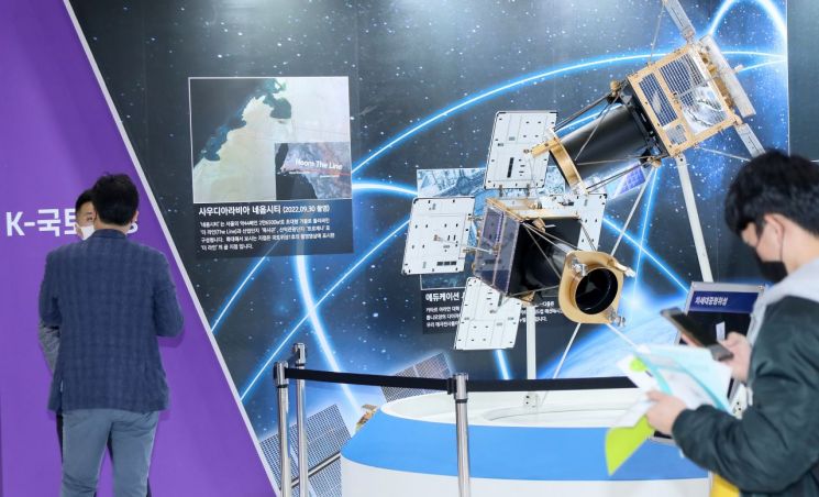
 On the 2nd, at KINTEX in Goyang, Gyeonggi Province, a visitor is observing a South Korean earth observation satellite image capturing Saudi Arabia's NEOM City at the "Smart Land Expo."
 [Image source=Yonhap News]
[Asia Economy Reporter Cha Wanyong] The Ministry of Land, Infrastructure and Transport announced on the 29th that it will hold a Land Satellite Image Utilization Policy Forum at the National Assembly on the 1st of next month to establish service utilization models and activation plans for the Land Satellite (Next-Generation Medium-Sized Satellite No. 1) imagery.
At this forum, private sector experts from CJ Olive Networks, Davio Co., Ltd., and others will present various utilization plans for satellite imagery, including demand forecasting using satellite images and big data, and metaverse data construction. They will also engage in discussions with experts from industry, academia, research institutes, and government agencies.
The Ministry of Land successfully launched Land Satellite No. 1 on March 22 last year. The satellite images captured by the Land Satellite are precisely corrected at the Land Satellite Information Center and processed into orthoimages. These are provided through the Land Information Platform of the National Geographic Information Institute for use in land monitoring, resource management, disaster and emergency response, and national spatial information sectors.
Additionally, the Ministry plans to hold a "Land Satellite Special Photo Exhibition" at the Land Development Exhibition Hall for one month starting December 23, where visitors can view satellite photographs.
Kang Juyeop, Director of Land Information Policy at the Ministry of Land, Infrastructure and Transport, stated, "To enable South Korea to leap forward as a space power, the Ministry will take the lead in strengthening communication and cooperation with stakeholders in the space industry from industry, academia, research, and government, and provide unwavering support."
Meanwhile, the Ministry is preparing for the launch of Land Satellite No. 2 in 2024. Upon success, operating two satellites simultaneously will shorten the revisit cycle for imaging the Korean Peninsula region (from 5 days to 2.3 days), enabling faster disaster and emergency services and acquisition of stereo images.
© The Asia Business Daily(www.asiae.co.kr). All rights reserved.


