NASA Earth Observatory Selects Hinamno's Image as 'Photo of the Day'
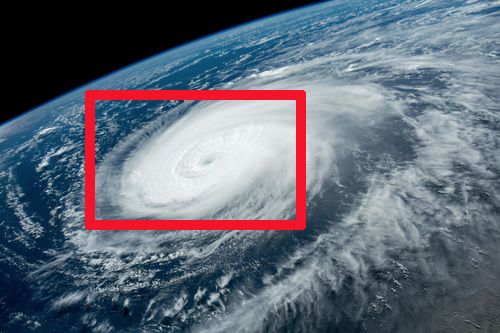 Hinamnor captured by an astronaut aboard the International Space Station (ISS) on the morning of the 31st of last month. Photo by NASA Earth Observatory website capture
[Asia Economy Reporter Kim Jung-wan] NASA's Earth Observatory has selected a photo of Hinnamnor taken from space as the 'Photo of the Day.'
The photo released on the 4th (local time) by NASA's Earth Observatory shows Hinnamnor, photographed by astronauts aboard the International Space Station (ISS) on the morning of the 31st of last month, and Hinnamnor captured on the 1st of this month by the Aqua satellite launched by NASA to improve weather forecasting and observe climate change, using a sensor called 'MODIS' (Moderate Resolution Imaging Spectroradiometer).
NASA's Earth Observatory described Hinnamnor as this year's first 'Category 5' typhoon. It added, "The first Category 5 typhoon this year occurred quite late, and globally, an average of 5.3 Category 5 typhoons occur annually."
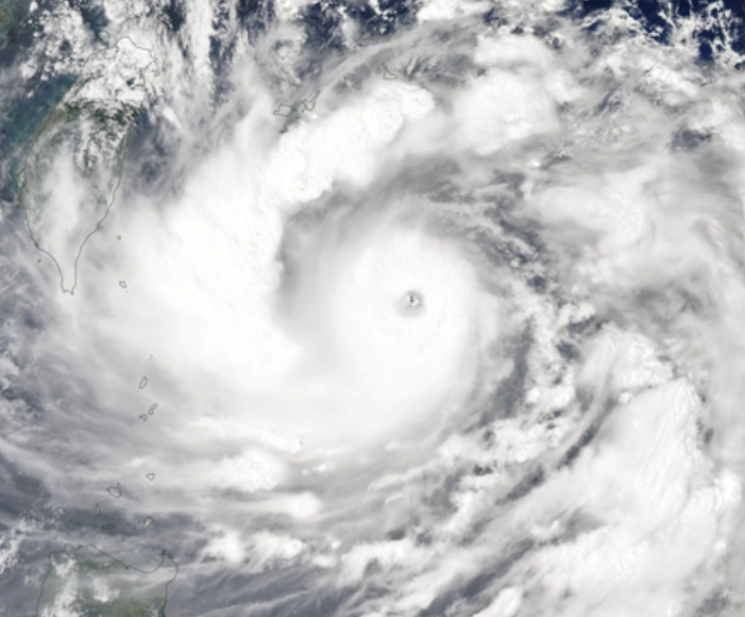 The Aqua satellite launched by NASA to improve weather forecasting and observe climate change captured Hinnamnor on the 1st of this month. Photo by NASA Earth Observatory website capture
The Cheollian Satellite 2A captured footage at 6:50 PM on the 4th, showing Hinnamnor passing over the northeastern sea of Taiwan. As of 3 PM that day, Hinnamnor was classified as a 'very strong typhoon' with a central pressure of 935 hPa (hectopascals).
In the satellite images, the 'eye of the typhoon' is clearly visible at the center of Hinnamnor. This indicates that the typhoon's structure is systematically well-organized. As Hinnamnor moves northward, it is expected to strengthen and become a 'super typhoon' again by the early morning of the 5th. According to forecasts, Hinnamnor is likely to make landfall in South Korea with the strongest intensity.
The typhoon intensity stages are divided into four levels: 'medium - strong - very strong - super.'
© The Asia Business Daily(www.asiae.co.kr). All rights reserved.


