Starting from the 21st, Providing Life and Safety Related Information
[Asia Economy Yeongnam Reporting Headquarters Reporter Lee Seryeong] Gyeongnam Province will provide information closely related to residents' lives and safety on the spatial information platform starting from the 21st.
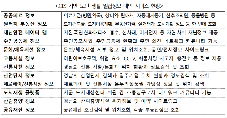
They plan to offer integrated real estate information, disaster safety, public healthcare, cultural and sports facilities, transportation facilities, Zero Pay, traditional markets, and forest recreation information that are not provided by private portals.
The province stated that it is promoting the spatial information platform construction project based on the concept that "All policy activities are located somewhere (Making special decisions)."
They explained that administrative information with location data is displayed on maps, enabling spatial analysis to scientifically support policy decisions while meeting the diverse spatial information demands of residents.
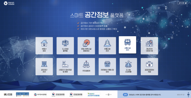
According to Gyeongnam Province, the second phase of the project was completed in May, starting first with the internal administrative system, and public services will begin on the 21st.
By accessing the Gyeongsangnam-do Smart Spatial Information Platform via computer or mobile phone, users can receive map-based information related to medical facilities, postpartum care centers, pharmacies, animal hospitals, earthquake/heatwave/cold wave shelters, disaster safety, transportation facilities, culture, marine leisure, recreational forests, and leisure activities.
Integrated real estate information such as land registers, building registers, land use plans, publicly announced prices, and actual real estate transaction prices for desired parcels, as well as urban planning announcement information and district unit planning information, can be viewed overlapped with the national spatial information of V-World.
Provincial officials use this platform to utilize spatial information such as Digital Elevation Models (DEM), digital maps, 150 types of national spatial information from V-World, urban planning announcement information, and 3D indoor spatial information in their work.
Excel data with addresses or coordinates can be displayed on the map (geocoding), and spatially analyzed data can be shared between departments.
Following the completion of the second phase, Gyeongnam Province plans to officially begin the third phase of the advancement project in July.
In the advancement project, they plan to build 3D terrain information, develop utilization models such as real estate portals and aquaculture farm information, and construct and provide administrative information related to residents' safety and high-precision spatial information.
Heo Dongsik, Director of the Urban Transportation Bureau, said, "The Smart Spatial Information Platform construction project is not only an internal administrative innovation but also a project that provides information closely related to residents' daily lives based on maps," adding, "We will continuously strive to become a user-centered communication platform by providing reliable information."
© The Asia Business Daily(www.asiae.co.kr). All rights reserved.


