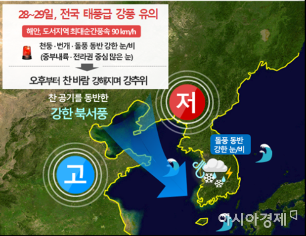
Typhoon-Force Winds Over 90km/h
Heavy Snow in Central Inland and Eastern Jeolla on 28th
Morning Low Temperature Drops to -10°C on 29th
[Asia Economy Reporter Han Jinju] From the afternoon of the 28th, typhoon-level strong winds will blow, causing temperatures to drop below freezing and snow and rain to fall nationwide. Caution is advised for road conditions during commuting hours and the safety of facilities due to strong winds.
The Korea Meteorological Administration forecasted that very strong winds will blow nationwide on the morning of the 28th, and temperatures will drop sharply from the afternoon. Due to the influence of high pressure approaching from the west, the pressure difference increases, allowing cold air from the north to flow in, accompanied by strong winds that lower the temperature. The minimum temperature on the morning of the 29th will fall below minus 10 degrees Celsius.
A low-pressure system accompanied by strong winds and precipitation will pass north of South Korea, and it is expected that 1 to 5 cm of snow will accumulate in Seoul and the metropolitan area. From the afternoon, temperatures will drop sharply and winds will strengthen, causing many roads to become icy, so caution is needed for traffic safety during the evening commute.
The Meteorological Administration stated, "Recently, temperatures have been maintained about 5 to 10℃ higher than average, resulting in relatively mild conditions, but temperatures will rapidly drop to about 5℃ lower than average, making the perceived cold stronger," adding, "Since the wind chill will drop by more than 10℃, it is important to keep warm."
From the morning of the 28th, rain or sleet will begin falling in the western regions and will expand to most parts of the country from midday. In areas with lower temperatures such as eastern Gyeonggi and Gangwon provinces, snow will fall instead of rain. In other areas where rain has been falling, the inflow of cold air starting from midday may cause precipitation to change to snow.
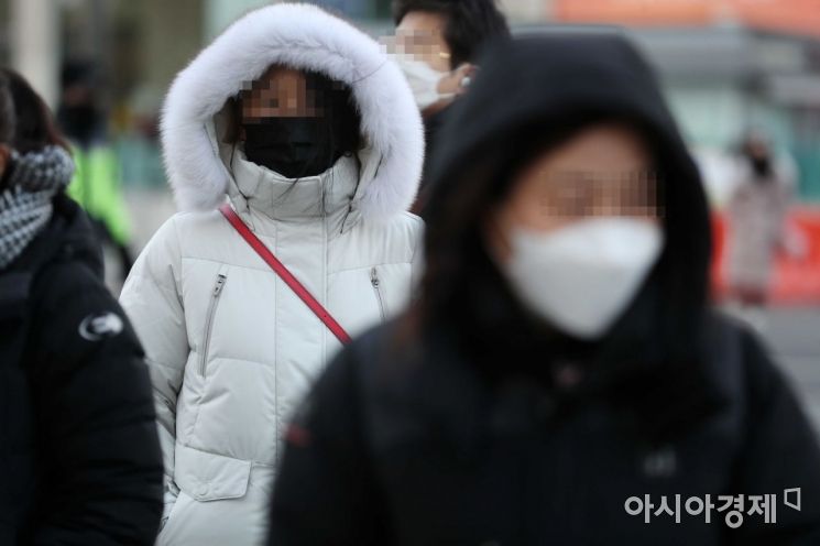 On the 19th, when a sudden cold snap with temperatures dropping below minus 10 degrees Celsius arrived, citizens wearing thick clothes hurried their steps at the Gwanghwamun intersection in Seoul. Photo by Mun Ho-nam munonam@
The expected snowfall on the 28th is forecasted to exceed 10 cm in eastern Gyeonggi, Gangwon, Jeolla regions, and Chungbuk, with snowfall exceeding 15 cm in the inland eastern Jeolla and mountainous areas of Jeju Island, where heavy snow warnings may be issued. Snowfall in the metropolitan area, inland Gyeongbuk, southern coastal areas of Jeonnam, and Chungnam is forecasted to be 1 to 5 cm.
From the morning of the 28th, strong winds with speeds of 7 to 18 m/s will begin blowing starting from the islands in the West Sea, and there is a high possibility of strong wind warnings being issued in most parts of the country. Gusts exceeding 90 km/h may occur in Jeju Island, coastal, and island areas. Starting from the West Sea, waves are expected to rise to 2 to 6 meters in the South and East Seas from the afternoon, and storm warnings are likely to be issued.
A meteorological forecaster advised, "Facilities such as outdoor screening clinics, construction sites, and vinyl greenhouses should be thoroughly prepared in advance to prevent damage from strong winds and falling objects," and added, "Flight and maritime vessel operations may be disrupted, so it is essential to check navigation information beforehand."
The Meteorological Administration forecasted that the timing of the change to snow and the amount of snowfall may vary depending on ground temperatures, and there will be significant differences in snowfall amounts depending on altitude and terrain in different regions. Depending on when the cold air arrives, precipitation may change from rain to snow. The Meteorological Administration will strengthen monitoring of ground and lower atmospheric temperature changes and plans to release weather information every 1 to 2 hours starting from early morning on the 28th.
The Meteorological Administration explained, "As a cold front passes through the metropolitan area, warm air will gather on the right side and cold air on the left, causing large temperature differences between regions," adding, "There may be differences in snowfall amounts between the eastern and western parts of Seoul."
© The Asia Business Daily(www.asiae.co.kr). All rights reserved.


