This Winter's Cold Wave Peaks... Seoul Today (8th) at -18°C
Cause of Cold Wave: 'Negative Arctic Oscillation'
Subzero Severe Cold Expected to Continue Until the 12th
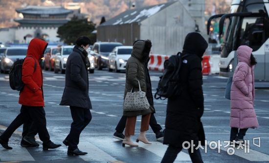 On the 8th, as the Arctic cold wave peaked with Seoul's morning low temperature dropping to minus 17 degrees Celsius, citizens heavily dressed in thick clothing hurried on their way to work near Gwanghwamun Intersection in Seoul. Photo by Hyunmin Kim kimhyun81@
[Asia Economy Reporter Heo Midam] On the 8th, as the cold reached its peak, temperatures in some inland central regions dropped below minus 20 degrees Celsius, causing the entire country to freeze solid. The Korea Meteorological Administration (KMA) identified the 'Arctic Oscillation' as the main cause of the cold wave.
The Arctic Oscillation refers to the phenomenon where the vortex of cold air over the Arctic fluctuates in strength. When this air approaches South Korea, it literally becomes 'Arctic cold.' As a result, this winter is expected to be colder than Moscow, Russia.
According to the KMA, the morning temperatures at 7 a.m. were △Seoul -18.3°C △Incheon -17.3°C △Suwon -18.4°C △Daegwallyeong -24°C △Chungju -19.3°C △Wonju -17.3°C △Jeonju -16.5°C △Daegu -13.5°C.
The inland central region, eastern Jeonbuk, and northern inland Gyeongbuk recorded temperatures below -20°C, while other central areas, western Jeonbuk, northern Jeonnam, other parts of Gyeongbuk, and western inland Gyeongnam also experienced very cold temperatures below -15°C.
In particular, this winter has recorded temperatures much lower than those of major Arctic countries. As of 7 a.m. on this day, Moscow's temperature was -4°C, whereas Seoul recorded -18°C. The wind chill was -9°C in Moscow but -24°C in Seoul.
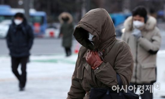 On the 8th, when the Arctic cold wave peaked with the morning low temperature in Seoul dropping to minus 17 degrees Celsius, citizens heavily dressed in thick clothing hurried on their way to work near Gwanghwamun Intersection in Seoul. Photo by Kim Hyun-min kimhyun81@
The KMA analyzed the cause of this winter's cold as the effect of a 'negative (-) Arctic Oscillation.' When the Arctic warms and the Arctic Oscillation index shifts to negative, the jet stream in the upper atmosphere weakens. During this process, the cold Arctic air moves southward. This is why this cold wave is called 'Arctic-origin cold.'
Conversely, when the Arctic Oscillation index has a positive (+) value, it means the cold air remains in the north, resulting in a relatively warmer winter.
The relatively warm winter of 2019 was also due to a 'positive (+) Arctic Oscillation.' According to the '2019 Climate Change Monitoring Comprehensive Analysis Report' released by the KMA, the Arctic Oscillation showed strong positive (+) values in February and March 2019, while it showed negative (-) values in January 2019.
This means January was cold, but February and March were warm. In fact, the average temperature in South Korea during February and March 2019 was more than 1 degree Celsius higher than the normal average (1981?2010).
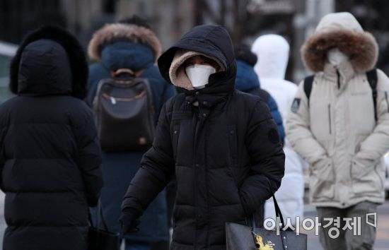 On the 8th, when the Arctic cold wave peaked with the morning low temperature in Seoul dropping to minus 17 degrees Celsius, citizens heavily dressed in thick clothing hurried on their way to work near Gwanghwamun Intersection in Seoul. Photo by Hyunmin Kim kimhyun81@
This winter's cold is expected to continue until mid-January. According to the three-month forecast (January to March 2021) announced by the KMA on the 23rd of last month, the Arctic Oscillation was in a positive state until the end of November last year but shifted to a negative (-) Arctic Oscillation from mid-December.
The KMA forecasts that this negative Arctic Oscillation will persist until mid-January. Accordingly, temperatures in January are expected to be lower than average.
There was also a case when a negative Arctic Oscillation led to a cold wave at the end of 2010. From December 24, 2010, to January 31, 2011, a cold wave lasted for 39 days. At that time, the Arctic Oscillation recorded values below -4, marking the lowest in 50 years.
Meanwhile, although the cold will gradually ease after peaking on the 8th, temperatures are expected to remain below average until the 12th. Additionally, snow is forecasted for Honam and Jeju Island over the weekend and early next week.
The KMA advised, "Snow intensity is expected to weaken and enter a lull until daytime today (the 8th), so some heavy snow warnings will be lifted in certain areas. However, snow intensity is expected to strengthen again from this evening, so please refer to the upcoming weather information."
© The Asia Business Daily(www.asiae.co.kr). All rights reserved.


