[Asia Economy Beijing=Special Correspondent Sunmi Park] China used advanced technologies such as 5th generation (5G) and satellite positioning system (GPS) to climb to the summit of Mount Everest, the highest peak in the Himalayas, and re-measure the mountain's height.
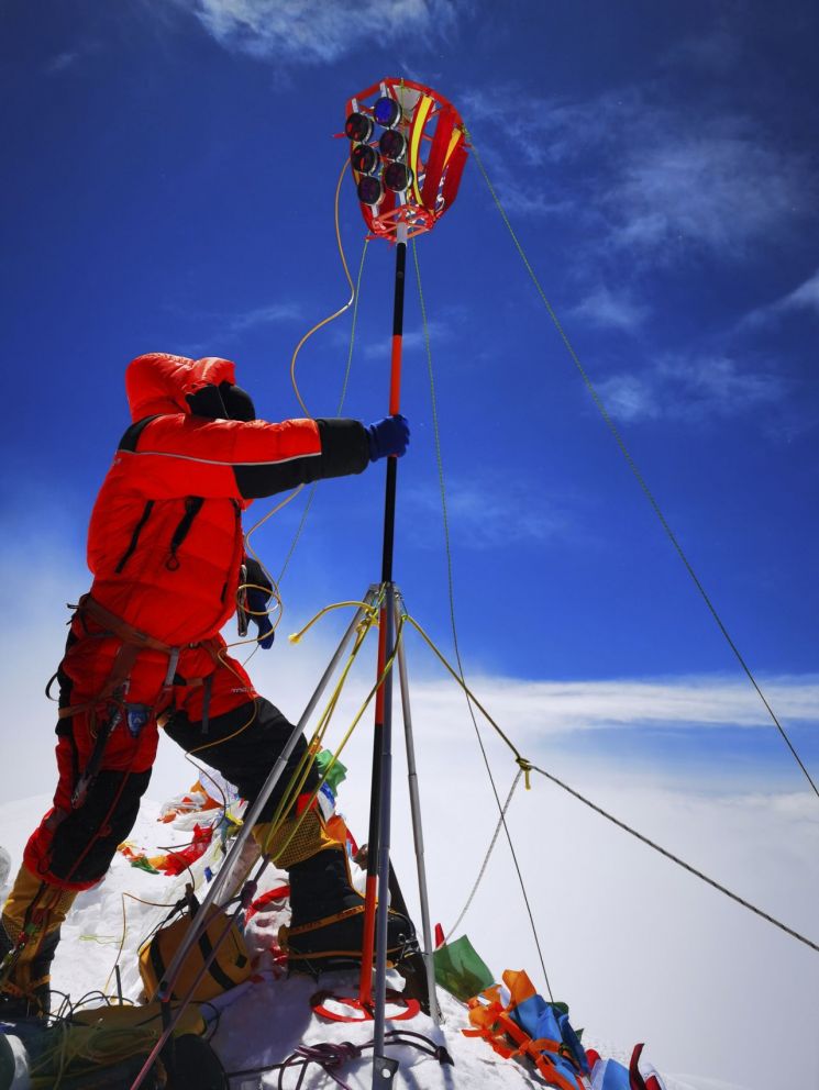
According to Xinhua News Agency on the 28th, the Chinese surveying team departed from the base camp at an altitude of 8,300 meters at around 2:10 a.m. local time the previous day and reached the summit about nine hours later at 11 a.m. The climb was for the purpose of re-measuring the height of Mount Everest.
The currently internationally recognized official height of Mount Everest is 8,848 meters, but China undertook the re-measurement using advanced technology. During the approximately two hours spent at the summit, the surveying team set up surveying markers to enable other surveyors located at altitudes between 5,000 and 6,000 meters to perform cross-surveys. They also measured snow accumulation using radar and confirmed the exact location of the summit using satellite data. The precise measurements and related data are expected to be announced in two to three months.
Dang Yamin, head of the altitude measurement technology coordination team for this project, stated, "Since Mount Everest rises about 4.4 mm every year, it grows approximately 10 cm over 20 to 30 years," explaining the necessity of re-measurement.
There is also analysis that the Mount Everest height re-measurement project contains an intention to showcase China's 'scientific rise.' In fact, China Central Television (CCTV) used 5G communication technology implemented by Huawei and China Mobile to broadcast the surveying team's summit ascent live, watched by millions. The state-run media Global Times also emphasized that domestic technologies such as 5G mobile communication and the Chinese GPS system called 'Beidou' played a role in this altitude measurement.
© The Asia Business Daily(www.asiae.co.kr). All rights reserved.


