Cultural Heritage Administration to Deploy Drones Equipped with AI Video Analysis Technology Year-Round Starting Next Year
[Asia Economy Reporter Lee Jong-gil] Drones equipped with artificial intelligence (AI) video analysis technology will be deployed for the safety management of cultural heritage sites. The Cultural Heritage Administration announced on the 23rd that it will establish a safety management strategy using drones equipped with AI video analysis technology by the end of the year and will deploy drones on a regular basis starting next year.
These drones will fly over safety management sites to perform inspection and surveillance functions. They will be especially used to monitor cultural heritage sites located in large areas where it is difficult for personnel to be stationed, as well as to assess damage to cultural heritage in the event of disasters. The Cultural Heritage Administration explained, “By accumulating video footage while flying over cultural heritage sites, it is possible to compare conditions before and after disasters.”
From April to December last year, the Cultural Heritage Administration formed an expert task force to review the current status and utilization plans of drone technology for disaster safety in cultural heritage. They determined that autonomous patrol, anomaly detection through video analysis, drone stations equipped with automatic charging facilities, and real-time video transmission technology are necessary, and are exploring ways to secure these capabilities. The Cultural Heritage Administration stated, “The types and quantities of drones will be finalized in the second half of the year.”
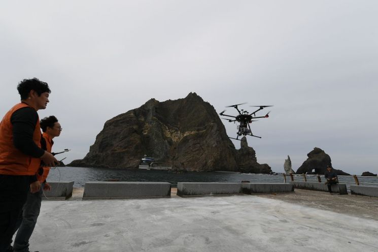
The use of drones in cultural heritage investigation and excavation sites is no longer unfamiliar. Last year, the National Research Institute of Cultural Heritage introduced a drone equipped with advanced LiDAR (Light Detection And Ranging) technology capable of laser scanning on Dokdo. This drone flew over the approximately 187,000㎡ natural protection area of Dokdo, conducting detailed surveys of terrain and vegetation.
© The Asia Business Daily(www.asiae.co.kr). All rights reserved.


