Production of Digital Cadastral Maps Using Drones and Precision Surveying
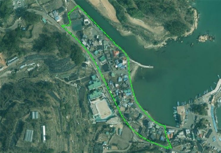
Targeting 112 Parcels, 28,949 Square Meters
Gijang County (Governor Jung Jongbok) will begin full-scale implementation of the cadastral resurvey project for the Jukseong 3 District (112 parcels, 28,949 square meters), which has been designated as this year's cadastral resurvey project area.
The cadastral resurvey project is a national mid- to long-term initiative that converts paper cadastral maps created during the Japanese colonial period into digital format, corrects land boundaries that do not match actual usage, and improves the accuracy of cadastral maps.
Through this project, land-related disputes can be prevented, fair land administration can be realized, and the value of land utilization can be enhanced.
The county has already completed on-site surveys for each parcel using drones and precision surveying equipment, and plans to proceed with boundary adjustments and installation of temporary boundary markers based on these results. In addition, administrative procedures such as updating cadastral records and correcting registrations will be carried out in parallel.
Governor Jung Jongbok stated, "Through this cadastral resurvey, we will resolve long-standing boundary disputes and issues of cadastral inconsistency, and protect the property rights of residents clearly and fairly," and added, "We ask for the active cooperation of residents for the smooth progress of the project."
© The Asia Business Daily(www.asiae.co.kr). All rights reserved.


