Upgrade of the "Urban Landscape Record Website"
Drone Photography of Scenery, Historical and Cultural Assets, and Urban Parks
"Sharing Urban Charm"... Resources to Be Used for "Visit Gwangju Year"
The city of Gwangju is unveiling vivid photographs capturing the region's beautiful natural scenery and distinctive urban landscapes to citizens and tourists.
Gwangju has updated its "Gwangju City Urban Landscape Record Website," a platform that documents and shares the city's changes and memories through photographs. This update was carried out to precisely record and manage the city's evolving appearance and major landscape information, supporting its use in various fields such as tourism, urban planning, public design, and civic communication.
Previously, in December 2020, the city launched the "Gwangju City Urban Landscape Record Website" to collect and disclose a variety of urban landscape images of Gwangju. Through the latest update, users can now view both the cityscape of the first half of this year and that of 2020.
Notably, city employees directly operated drones to capture videos and photos, building a more vivid and reliable collection of materials. This approach is credited with reducing costs and enabling the acquisition of real-time, field-oriented data.
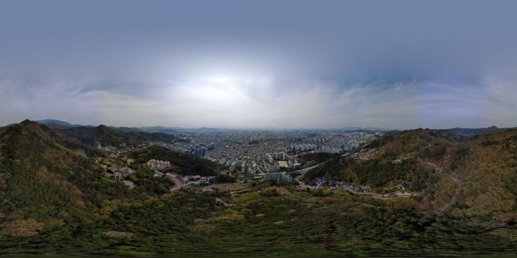
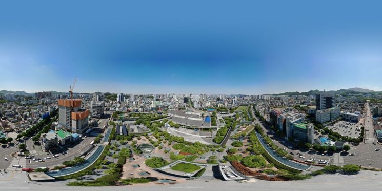
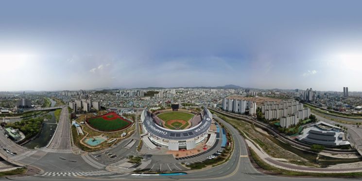
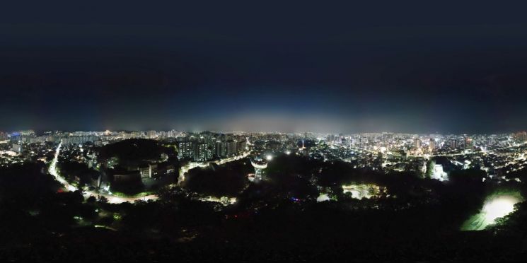
The drone photography focused on areas with significant changes or high tourism value, including Mudeungsan Observatory, Jisan Amusement Park, Gwangju-Kia Champions Field, Sajik Tower Observatory, Pungam Lake, and the National Asia Culture Center. The project covered Gwangju’s representative scenic sites, high-rise buildings in the city center, historical and cultural assets, and urban parks and green spaces.
The results of these shoots are available for anyone to view through the Urban Landscape Record Website. In addition to standard images, the site also offers 360-degree virtual reality (VR) views that can be explored from various angles.
In particular, a variety of visual information showcasing the charm of Gwangju, such as nightscapes, has been added. This is expected to make it easier for both citizens and tourists visiting Gwangju to discover places to visit.
The city plans to utilize these landscape records as foundational data for tourism during "2025 Visit Gwangju Year." The goal is to effectively convey Gwangju’s unique appeal and actively use the materials to enhance the city’s image and public communication.
The city will continue to ensure the accuracy and timeliness of its urban landscape records by making drone photography a regular practice and frequently updating data for areas experiencing significant change.
On July 14, Jeong Seungcheol, head of the Architectural Landscape Division, stated, "By having our staff directly build this collection using drones, we are now able to provide vivid and highly reliable urban landscape information. We will continue to improve the urban landscape record platform so that it can be widely used in tourism, policy-making, civic communication, and other diverse fields."
© The Asia Business Daily(www.asiae.co.kr). All rights reserved.


