Utilized for Crackdowns on Illegal Construction and Public Land Violations
Citizens Can Also Access via the Living Space Web Portal
Hwaseong City in Gyeonggi Province announced on April 22 that it has completed the creation of high-resolution digital aerial photographs covering the entire city and has released them through its Geographic Information System (GIS) and the Living Space Web Portal operated by the city.
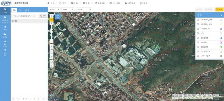 High-resolution digital aerial photograph released on the 'Living Space Web Portal' by Hwaseong City. Provided by Hwaseong City
The newly established aerial photographs are intended to continuously manage information on topographical and physical changes resulting from various development projects and to serve as basic data for administrative tasks. These are the latest materials produced between March and November of last year.
The information will be widely used for a range of administrative purposes, including time-series management of changes in the city's topography, crackdowns on illegal buildings, investigation and assessment of housing prices, and review of illegal activities on public and state-owned land.
The city is also providing this information through the Living Space Web Portal, enabling citizens to conveniently check and utilize topographical information without having to visit sites in person.
In particular, the city expects to achieve an annual budget saving of approximately 200 million won, as the aerial photographs were provided free of charge by the National Geographic Information Institute.
Kim Kyujin, head of Hwaseong City's Smart City Division, stated, "With the latest aerial photographs, citizens can directly observe the changing landscape of the city and make practical use of this information in their daily lives. We will continue to build high-quality aerial photographs and spatial information to further enhance citizen satisfaction with spatial data."
© The Asia Business Daily(www.asiae.co.kr). All rights reserved.


