Myanmar, where a magnitude 7.7 earthquake occurred, is located at the intersection of several tectonic plates and has been classified as an earthquake-prone area. In particular, the area near Mandalay, where the earthquake struck on the 28th, lies on the 'Sagaing Fault,' which is the boundary between the Indian Plate and the Sunda Plate or the Indian Plate and the Burma Plate.
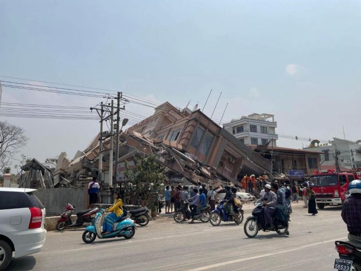
According to Indian media such as India Today on the day, the Sagaing Fault stretches about 1,200 km, running north to south through Myanmar's territory. Along this fault line are major cities including Mandalay, which suffered significant damage from the recent earthquake, as well as the capital Naypyidaw and Yangon.
It is known that many earthquakes have occurred along this fault in the past. AFP cited data from the United States Geological Survey (USGS), reporting that six earthquakes of magnitude 7.0 or higher occurred near the Sagaing Fault between 1930 and 1956.
India Today reported that earthquakes in Myanmar, such as the magnitude 7.7 earthquake in 1946 and the magnitude 6.8 earthquake in 2012, are related to the Sagaing Fault.
© The Asia Business Daily(www.asiae.co.kr). All rights reserved.


